For better or worse, the United States of America that we know and love today was founded, changed, built and fought for with blood and conquest.
It’s a history that we often forget.
The U.S. borders have warped and moved countless times. In it’s earliest years, much of the land was owned and ruled over by different countries. Today, we are here at Palo Alto National Battlefield to learn about the history of this very small corner of Texas and the U.S. Mexican War. The Palo Alto National Historic Park is the only National Park Unit to interpret this war.
The park introduction reads as follows: “On May 8th, 1846, United States and Mexican troops clashed on the prairie of Palo Alto. The battle was the first in a two-year long war that changed the map of North America”.
I need to stop here for a moment and make a confession. I’ve never heard of this battle. If I was taught about it in school it’s long since been buried, covered over by the words of every commercial jingle I’ve ever heard and the moves for how to dance the Macarena.
I’ll bet you can relate.
We forget. Time erases the past and makes way for the future, but the saying goes, “Those who forget the past are doomed to repeat it.”
These places are important, these memories are important.
On the day we visited, the park was empty but for a historian/bicyclist who told us that the park ranger was a fount of knowledge and we should appreciate him. We asked the ranger to tell us all he knew and he was indeed a fount of knowledge!
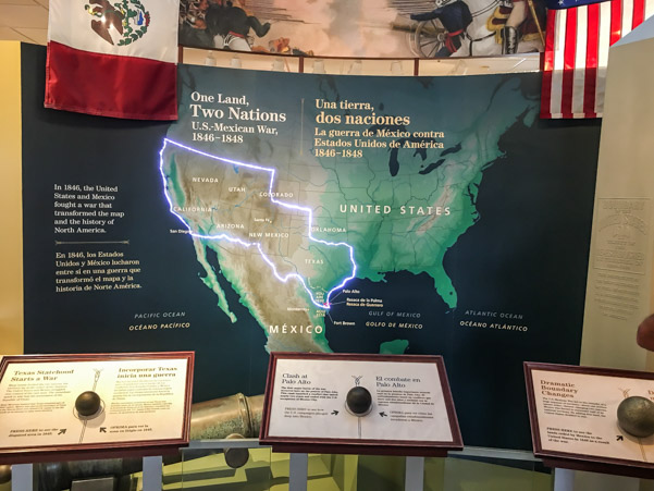
The main picture at the beginning of this post is of an interactive map which shows how the boundaries changed. The U.S. Mexican War transformed North America and by pushing a button on the map the boundary changes light up.
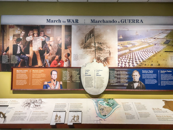
The boundaries between the U.S. and Mexico had been disputed for some time. President James K. Polk was determined to expand his country and disputed Mexico’s ownership claims of Texas. He also insisted that Texas stretched all the way to the Rio Grande.
I was particularly intrigued by the book below this display. Turning the pages showed the U.S. boundaries throughout history and the countries who laid claims to the land. I had forgotten how much effort, war and negotiation it took to create the country we enjoy today.
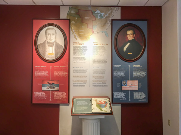
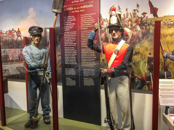
Displays show the aspects of the war from two different perspectives.


The U.S. had huge cannons and both heavy and light artillery, while the Mexican soldiers made do with ancient relics left over from Mexico’s Independence Wars.
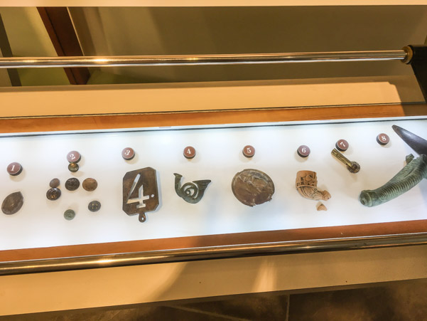
These are some archaeological finds from the battlefield.
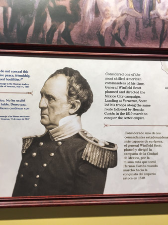
I was even more ashamed to admit that my knowledge of the Mexican-American War was lacking, when I was reminded, by a display, that Commander Winfield Scott played a huge part in the winning of the war. During my childhood, my father spoke of Winfield Scott frequently and referred to him by his nickname “Old Fuss and Feathers”. Apparently General Scott is a family relation and/or played an important part in my family history, on my father’s side.
I’m going to have to look into our genealogical records again!
There are two ways to explore the battlefield. The first is by walking a paved trail from the visitor center to the separate battle line, trails on the field itself. The second option is to drive to the battlefield and walk from there.
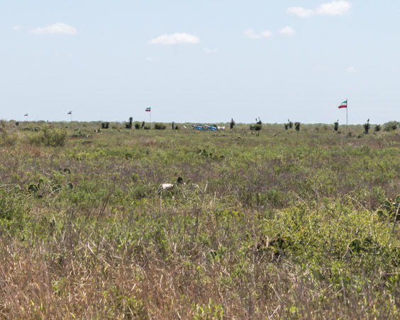
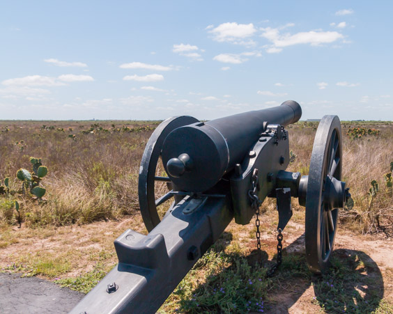
We went for option two and drove to the parking area. From there it’s possible to look out onto the entire battlefield. The site itself is so large that while there are flags marking the opposing sides, they’re difficult to see in the distance. The cannon picture above the page heading shows the view from this spot and the Mexican side of the conflict.
There are two trail options to hike, along the Mexican front lines or along the American front lines. Jeff and I are still a little sick so we choose to walk just the American side.

This picture shows the trailhead at the parking lot and a closer look at the Mexican flags which mark the battle lines and cannons in the distance
Turning to the right leads to the Mexican side of the trail.

Turning to the left leads to the U.S. side.


When walking through a quiet field of grass and cactus it’s next to impossible to appreciate the noise and chaos of a cannon battle.
The lilting voices of songbirds fill the air, the riotous color of blossoms dot the landscape as far as the eye can see, squirrels scamper through the brush…no smoke, no fire, no explosions.
How is it possible to understand the events that went on here?


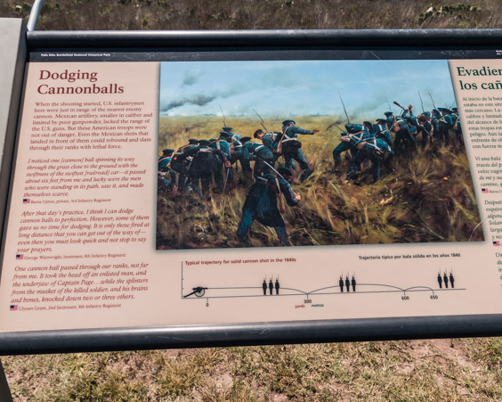
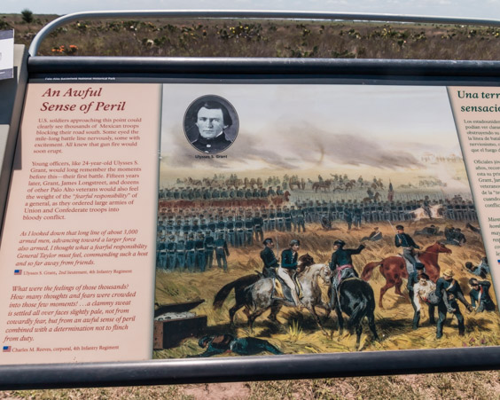
The park service has done a tremendous job of bringing history to life through the interpretive signs along the trail, by including testimonies of the conditions of war in the soldiers own words.
It’s impossible to read them and not be moved.

This is the U.S. line and flags in the distance.

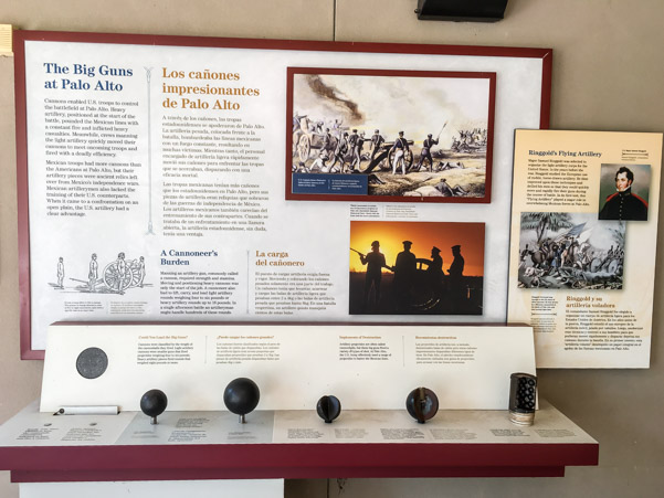
The huge U.S. siege cannon sits silent.

The siege cannon weighed so much that it could not be taken off the road and into the prairie. It fired 18 pound balls and according to one soldier “They made the earth tremble and cut the Mexicans down in heaps”.
Can you imagine standing here behind one of these monstrous guns?
Or what it would be like to dodge cannonballs?
What about staring at a line of guns pointing at you from across the field?
One of the things I personally never stopped to think about was what it took to keep that many men fed and supplied so far from home. What was it like to be a cook or a blacksmith behind the lines, doing their job while the cannons boomed?
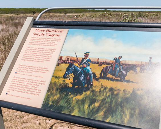
Were there this many cactus plants covering the field back then? Where did they put 300 wagons amongst all of them and how much of a factor were the spines while trying to dodge cannonballs? Things I never considered.

Sleeping, was it even possible? What an awful sight to wake up to!

Walking back to the car, over a boardwalk, we were reminded that a good portion of the land was marsh in the rainy season which added another level of difficulty and discomfort.

Visiting Palo Alto Battlefield gave me a new respect for the men and women who fought for our freedom and those who continue to do so every day.
Thank you!
Since the day is still early and we have no other plans, we decide to drive down the opposite side of the Port of Brownsville to Boca Chica State Park. I have to admit, I was hoping to see a little of the port industry and what we missed by not being able to have a boat tour, though I don’t hold out much hope.
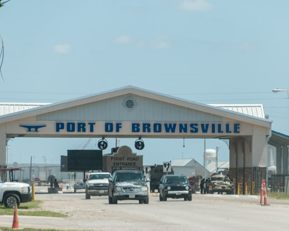
The entrance gate is as close as we’ve been so far.


That’s it for our industry tour.
Boca Chica State Park is the southern end of the barrier island that we visited yesterday at South Padre. You can drive on the beach here for free.

A right turn leads to the opening where the Rio Grande River meets the sea.
That is our first destination.

It’s quickly apparent that the oil is worse here.

While the ocean is beautiful, this side of the channel has a lot more trash in the dunes above and the oil is very bad in spots.

But it’s a short drive to reach the mouth of the Rio Grande.

There it is, Mexico on the opposite bank.

Looking upriver.
Once long ago, we took a trip, when our kids were very young. We were somewhere in Colorado and as usual driving the scenic route. We came around a corner, out of the mountains and there before us was the most beautiful river plateau we had ever seen. We pulled over to take pictures and saw a sign that identified it as the headwaters of the Rio Grande River. Something about that sight stayed with us. For years and years that picture was Jeff’s favorite computer background. To this day we still describe it as one of our top ten.
It’s only fitting that we’ve come here now to admire the other end.
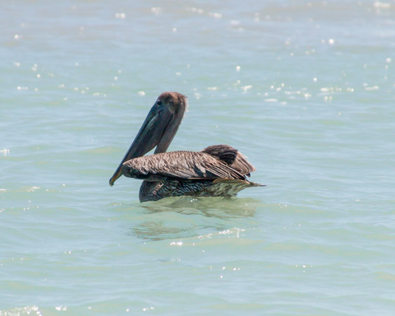
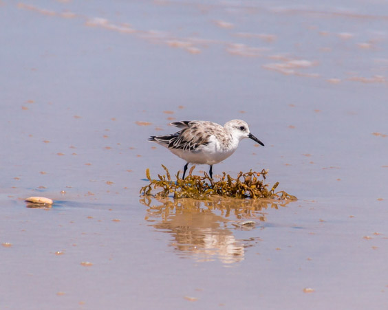
It’s a popular place, full of birds.
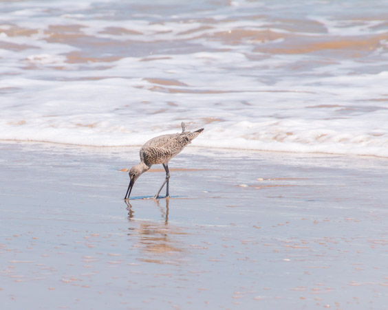
Some who don’t mind a little human trash.


I could watch these little birds for hours.
I believe these are Arctic Terns. They fly over the ocean until they spot a fish, then they tip their beak straight down as if pointing.
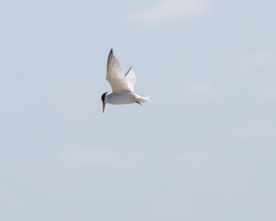
They dive down fast!
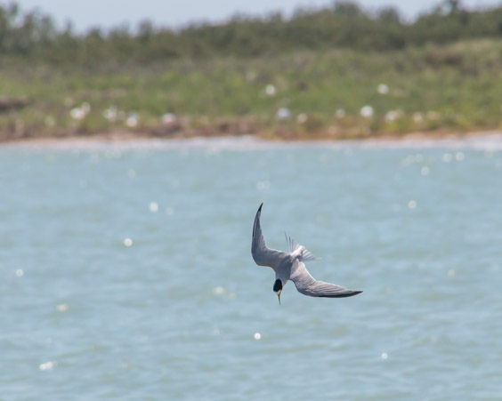
Straight as an arrow.
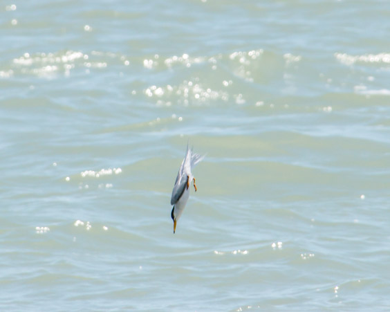
SPLASH!

Into the water and back up with the prize!
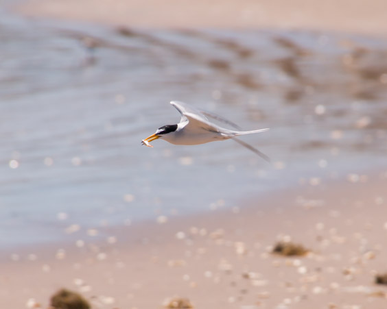
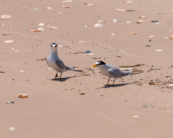
There’s usually some disagreement as to who it belongs to.
Up the river, the trash and oil are much worse here.

The sludge on the bank is oil residue and trash litters the dunes on the land side. I wonder, if the fact that the beach is free and not monitored the way the South Padre beach was makes much of a difference in cleanliness?

Regardless, it is a beautiful place popular with fisherman.


The two gentlemen in the background of this picture started fishing from the Mexican side but kept drifting further and further toward the American side as they fished. Once again, what borders? Everyone was out having a good time.
Human and bird alike.


Lets explore the other end of the island!
We startled a very large something which flew up in front of us.
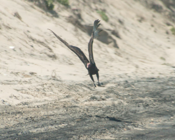
I have to say that a Turkey Vulture is not a bird I would expect to see on the beach.
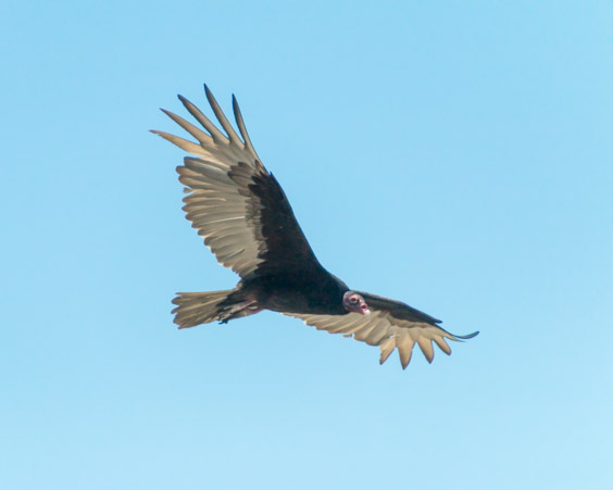
The wingspan is huge!

Shells litter the beach.


Though they are often marred by oil.

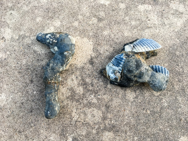
We found some unidentified objects which are probably conglomerations of solidified oil. Kind of ironic that one looks like a fish and the other like a seahorse.
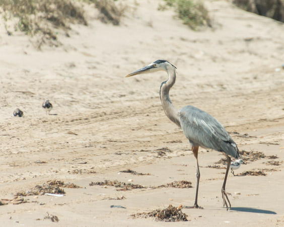
Birds of a different color.

Blue Herons congregate by fisherman.
The beach is narrow in places and sometimes littered with tires.

When we reach the jetty, South Padre Island’s hotels are visible in the distance.

The bridge rises through the haze.

On this side, it’s possible to walk along the jetty and watch the boats zipping up and down the channel.


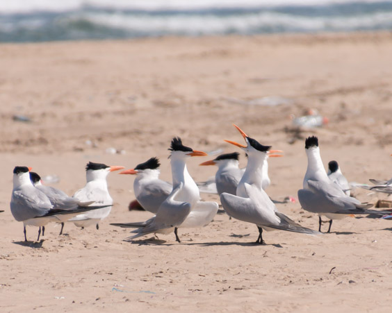
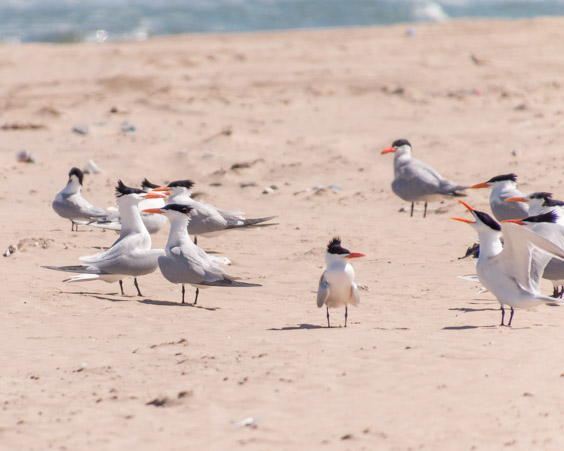
The Royal Terns use this spot for resting. They squawk and carry on at each other.
It’s also a popular spot for bathing while a friend keeps watch for you.

The “road” continues a little further around the point. The road ended at a beach where a lot of construction was going on.
A barge was unloading an excavator.

Pretty interesting to see how they used the bucket to help “walk” the excavator off the barge.
It startled a crane.

Old beach houses stood like sentinels.

Ravaged by weather, they appear to have been vacant for a long time.
Nothing more to see here, it’s time to head back to the road.
When I plan these “explorations” I often use Google Maps, and zoom in to see what might look interesting. While looking at the entrance to the Boca Chica Beach, the words “Space X Space Launch Facility” appeared over the top of a square of dirt on the digital map. Determined to figure out what it was while we were here, we slowed down to look. It’s a square mound of dirt surrounded by a chain link fence with a Space X sign on the front. We still have no idea whether it really is a launch site but there’s no infrastructure that we can see and it isn’t very big.
It’s a mystery!
We also noticed another marker on the opposite side of the road.

These pillars are remains of a railroad which transported military supplies.


At this point I need to share with you an interesting/annoying habit that Jeff has.
We can be driving along, on the way home after a fun day or on the way to have a fun day or really anytime at all, when suddenly he “sees” something that he thinks looks interesting. The next thing you know, he’s turned down some little “road” looking for who knows what.
Today, on the way home, he made a quick left turn onto a side road which led toward some ranch homes. I don’t know why. We followed the road to the end and turned around. Nothing to see here folks! We were almost back to the main road when we noticed a little marker. “The last battle of the Civil War”.
HUH?

Apparently, the last battle of the Civil War was fought in a nondescript field, in the “middle of nowhere” Texas and we happened to stumble upon it!

The battle of Palmito Ranch.

Once again, the silence is profound and there is nothing much to see.
You must use your imagination.
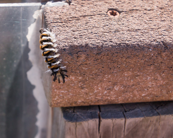
But life goes on, even after a war. Little bugs stay busy on a blossom…

A strange caterpillar is on a mission…

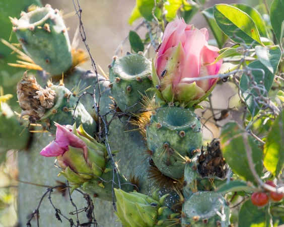
Plants and flowers are doing what plants and flowers do.
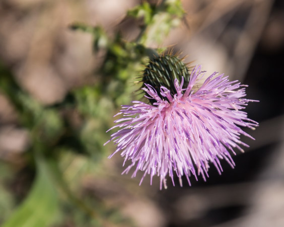
I like to take time to appreciate the details.
For those of you who would like to visit this small Civil War Battlefield, we discovered that there IS a marker on Boca Chica Blvd.

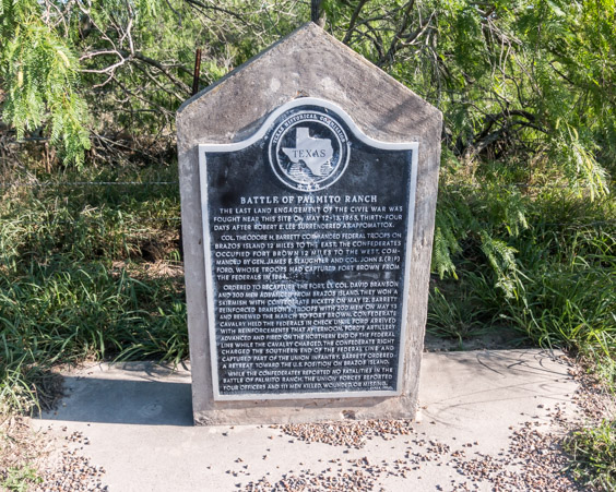
The sign and marker do not give very clear information on where the battlefield actually is though. The battlefield is located on a nearby, nondescript side road named Palmita Hill.
Happy Exploring!

A very enjoyable post. Loved the information, your thoughts on history, and the photos!
LikeLiked by 1 person