Sometimes the hardest part of traveling is finding a place to stay.
When planning trips we decide only on a general direction. The challenge then becomes where to stay, how long to stay there and hope there is an available place TO stay. Other criteria, which must also be met, makes finding a place even harder.
The proposed campground must adhere to the following rules:
- It must be quiet. No screaming children, barking dogs or traffic noise.
- It must have full hookups.
- It must be within a 50+ mile radius of activities.
- It must be no more than 300 miles from our last stop.
- I must be able to call to make a reservation and have it set in stone.
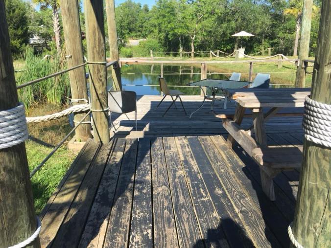
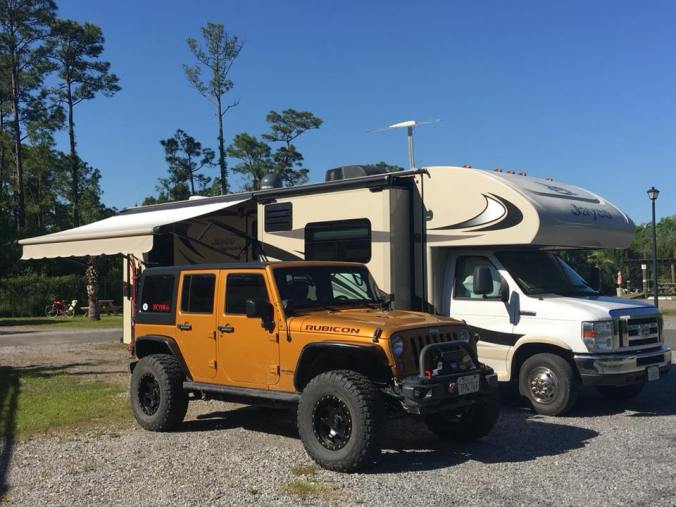
The reason for these self imposed guidelines is because we use our RV as a home base and not a destination in itself. We drive around exploring during the day, sometimes 200 miles or more. Other times, we spend all day in a museum. I want a relaxing place to come home to. That’s why I usually seek out the small campgrounds, off the beaten path. This stop was harder to find but no exception. I settled on Pass Christian RV Park, near Gulfport, Mississippi and about 50 miles east of New Orleans. It’s a tiny campground tucked away in a residential area, down the street from a cement fabrication plant (we never heard any noise or were bothered in any way). There is no camp host. To book a site, you call, they take a credit card, assign a site and you show up. The campground is very small, off a dirt road and absolutely quiet. There are no amenities to speak of except the little pond pictured above. All utilities worked great and it was a perfect home base.
We had a few activities planned for this spot, one of which was a visit to the nearby Infinity Space Center. The Infinity Space Center is a museum which offers a bus tour to the restricted John C. Stennis Space Center, America’s largest rocket engine test facility. Somehow we ended up doing other things and never made it to the museum. For now, it remains on my list as a “next time”.
But I digress…the drive from Carenco, Louisana to Pass Christian, Mississippi along the 10/12 freeway, was beautiful. We crossed bridges, swamps and waterways too numerous to count.


These bridges terrify me but there have been so many I’m starting to get used to it!

When we first arrive at a new place we usually like to spend the first day driving around, getting a lay of the land so to speak.
From our campground, it’s a short drive down to the coast road, then along the beach, over another bridge to The Gulf Islands National Seashore Visitor Center, our destination for today.
Some of the sights along the way.

Navy aircraft coming in for a landing at the nearby Naval Base.

The water is really shallow!


Shark souvenir shops.

…and gators.
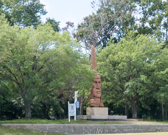
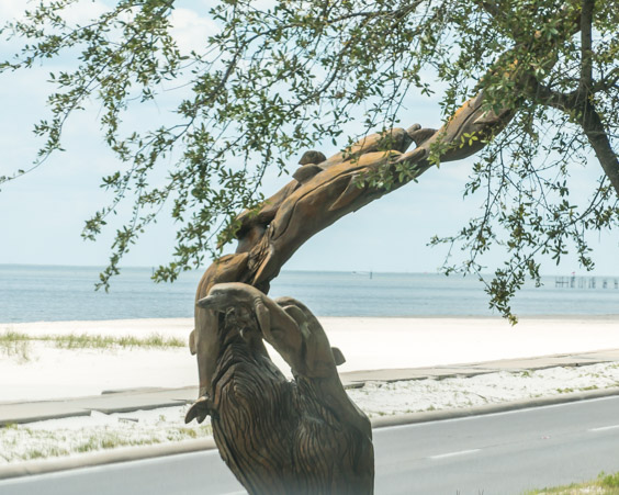
On my list of Roadside America sights to see, was this statue called Crooked Feather, located in Ocean Springs, Mississippi. Sculpted in 1999 by Thomas King it’s a replica of an Indian Head sculpted by Peter “Wolf” Toth. The original 1975 wooden head rotted.
Toth created a series of Native American sculptures called Trail of the Whispering Giants. Overall, he created over 74 sculptures, one in each state and several in Canada. The statue is located right next to the freeway, immediately after the bridge and it’s hard to see. A side road leads behind it but there is no way to get a picture from behind. It’s an artwork that must be enjoyed at high speed!
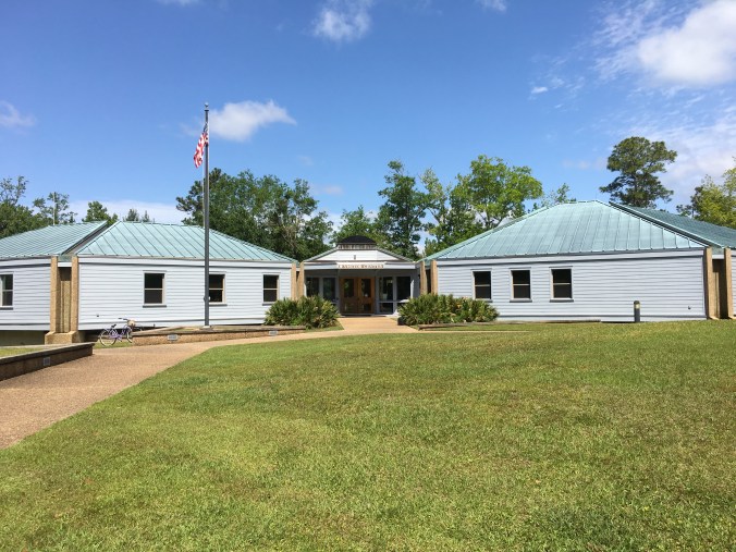
We found the entrance to the Gulf Islands National Seashore tucked behind a residential area. The road to the visitor center is lined with dense foliage and seems like the middle of the jungle, though houses are nearby. We found the visitor center at the end of the road.
The Gulf Islands National Seashore encompasses the barrier islands along the Gulf, from Mississippi into Florida. We’re visiting a very small section of it in our short time here. Many opportunities for hiking and biking are available directly from the visitor center but the barrier islands are only accessible by boat.
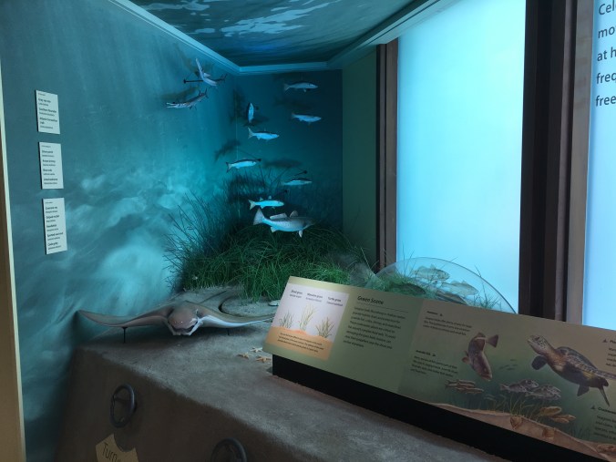
The visitor center has some nice displays of the wildlife and natural resources of the seashore.
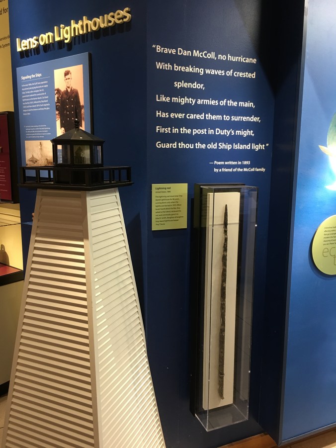
A display on the history of the Ship Island lighthouse. The case holds the lightning rod from the lighthouse. It stood atop it for 86 years, until the lighthouse burned. It looks like it’s seen some action!
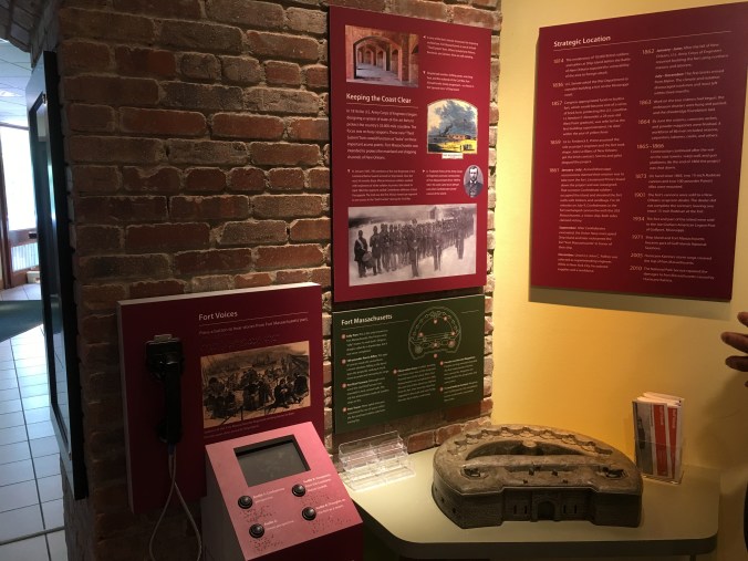
This display tells of the history of Fort Massachusetts. Fort Massachusetts can be visited on Ship Island.
Today, being a lazy day for us, we opted to take the park loop drive. The rangers assured us that we would see wildlife.
The first stop on the loop is a small pond overlook.

Very pretty, enjoying the scenery, not much to see…
Look a little closer…

In this picture are two turtles, two alligators and just out of sight a third alligator and a giant bullfrog.

Alligator one.

Turtle one.

Baby alligator.

Bullfrog.
The frogs were so loud! While we were standing there, a local man was telling us that these were the alligator children but the mother could usually be found in the larger waterway on the opposite side, across the bridge.

Nope, no alligators here!
We parked on the opposite side of the bridge, by the day use area. While walking toward the bridge, I noticed a couple who were pointing and taking pictures of a tree in the distance. I stopped to ask what they were looking at.
Osprey lunchtime!

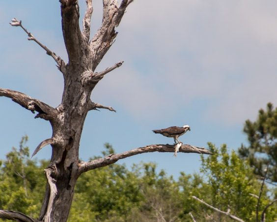
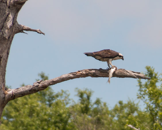
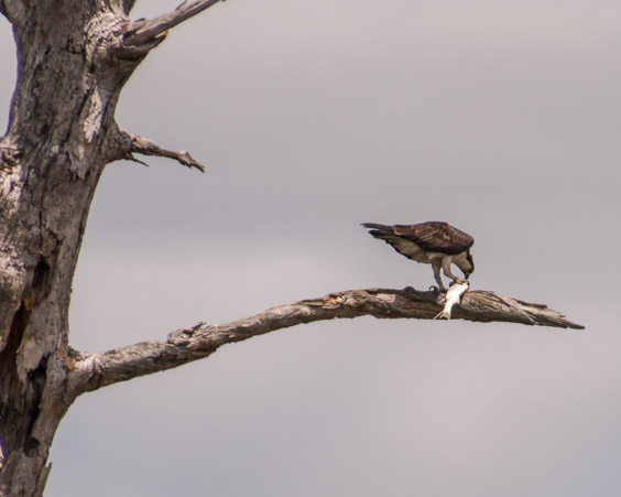
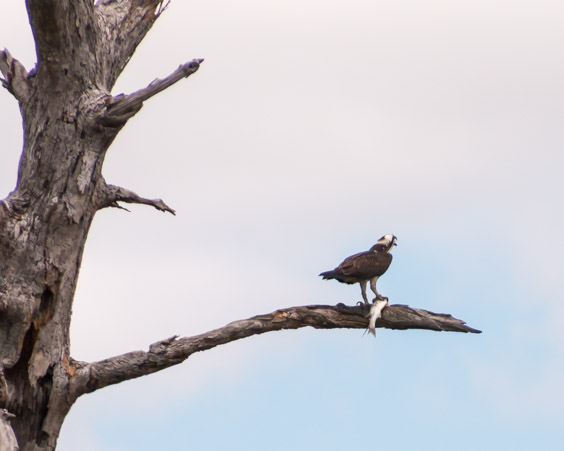
Every now and then, he’d pause to yell at someone in the trees in the distance. A few minutes later we noticed a huge crane circling around and swooping near the tree. That must have been why he was yelling.

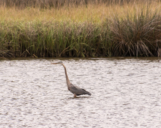
The ranger didn’t lie, we did see a lot of wildlife even in mid-day.
When we drove in on the loop road originally, we had noticed a short nature trail so we stopped to walk it.

One road in and one road out, a circle.

The trail was easy to follow for the most part. It seemed very isolated, yet there is civilization very close. We kept hearing an interesting tapping, crackling sound and little pieces of something dropping nearby. Try as we might, we couldn’t pinpoint the animal who was nibbling above our head.

The overlook and sign identifies this as a marshy wetland but it was quite dry.

The beautiful, dreamy trail.

Local tour guide.
It was a short but pretty walk.
We’ve done everything we can here at the park so we decide to head back to explore Gulfport further.

Back over the bridge.

The Ohr O’keefe Museum of Art.

So many beautiful buildings and homes along the coast.
One of the reasons I wanted to stay in this area is because of Hurricane Katrina. One year before Hurricane Katrina, we brought our family to New Orleans and the Gulf Coast for a family trip. We enjoyed the sights and sounds so much that we were shocked and saddened one year later when Hurricane Katrina and subsequent hurricanes destroyed the coast. At the time of the hurricane, our daughter Laura was attending Simpson University in Redding. Laura and a group of students, came down multiple times to New Orleans to help with cleanup efforts. The teams cleaned out destroyed homes, distributed food and performed other services. The people of New Orleans and the Gulf are near and dear to her heart and for that reason I was anxious to see what progress had been made in the rebuilding efforts in the years since.
Hurricanes not only destroy buildings and lives, they also break trees, leaving behind unsightly scars. As part of the rebuilding and beautification efforts, Gulfport used those left over snags to make art. These beautiful sculptures can be found all along the center median of the coast road.
Unfortunately, this is a fast traffic road and it’s hard to catch these as we drive by.
One of the most iconic images from Gulfport, after Hurricane Katrina, is that of the destroyed and grounded Treasure Bay Casino.

This photo above is from Pinterest, not my photo. It shows the beautiful casino before the hurricane and after. My photo, below shows it today.

The Treasure Bay Casino is now located far inland, across an empty concrete slab.


Remains of the original floor tiles in the Casino can be seen here. Huge support structures sit broken in the water. I wonder if these supported the floating ship or the building?

The force it must have taken to move such a huge structure just boggles the mind.

Now the remains are rest stops for birds.
There is still light left in the day, we continue down the coast road and stop on the beach looking back the way we came.


Whoever chose the colors for this building is a genius! Gorgeous!
Just across the bay from Pass Christian is the town of Waveland, Mississippi which many people don’t realize was the actual ground zero for Hurricane Katrina. There is a ground zero museum in town but it’s closed so we satisfy ourselves by driving down the coast to the end of the road.
As we drive, the devastation is evident even 10 plus years later. Empty lot after empty lot along the coast and in the historic district. Signs in the lots indicate which historic house was located there.

A few homes on stilts remain, possibly new or rebuilt?


Evidence of damage still remains.

Waveland was a vibrant, historical community and it’s sad to see so much damage, so many empty lots.
Our last stop for the day, a community fishing pier in Bay St. Louis.

Many birds congregate here, always the perfect way to end the day.

These birds crack me up, they look blind because of their black faces.

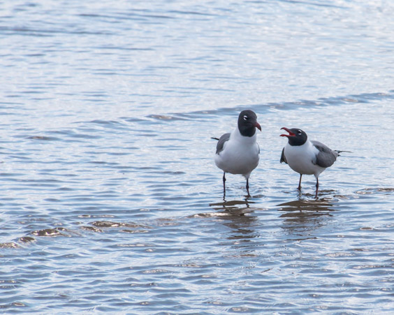
Mom! Mom! Mom!

Time to go!

the last birds looks funny the way they run around.
LikeLike
They were hilarious. They strutted around like businessmen in bad suits, every now and then stopping to argue with one another.
LikeLiked by 1 person
I can believe that 🙂
LikeLike