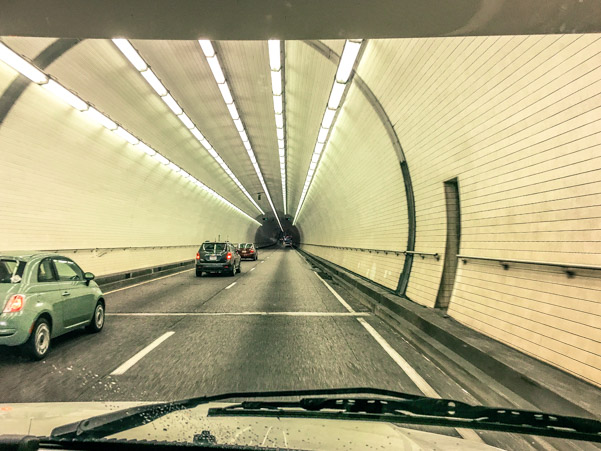
I love exploring new places, seeing things I’ve never seen before, being surprised. However, sometimes the anticipation of driving a new road while riding in a giant box which is towing behind it a smaller box, makes me nervous. Especially when there is an unexpected deviation in the roadway. In this case, a tunnel…
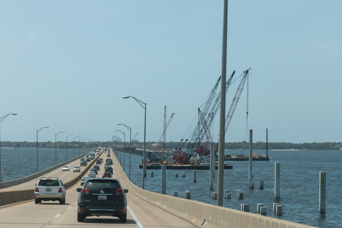
Florida is completely new territory for us. The night before our departure I checked the route on Google Maps. I was following (virtually) Interstate 10 to Pensacola, when suddenly the road disappeared! I was horrified to discover that interstate 10 travels under the bay in Mobile, Alabama via a tunnel. We have never driven the RV through a tunnel. Even though I logically knew (after research), that the RV could fit through the tunnel just fine, I managed to work myself into quite a state at the thought of it. Unfortunately the older I get, the more my nerves tend to get out of control.
Luckily, the next day dawned bright and clear, a beautiful day for a drive. I forced myself to breathe calmly as the tunnel approached.

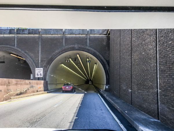
The tunnel was short, traffic was light, we fit through with plenty of room to spare and as usual I got worked up over nothing.
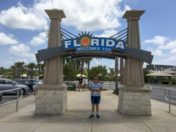
We continued on our merry way into Florida.
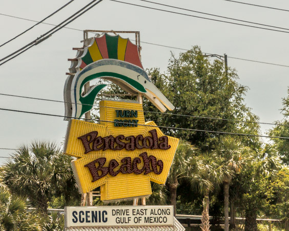
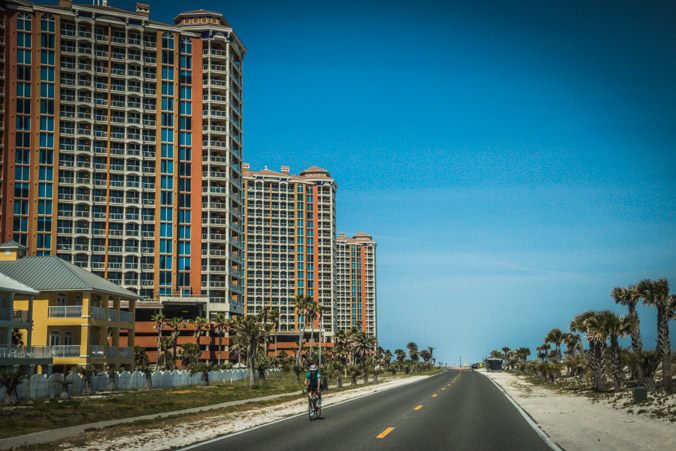
The well appointed visitor center in Pensacola welcomed us with freshly squeezed orange juice and cornucopia of tourist brochures.
We arrived at Pensacola RV Park in the early afternoon. It’s a beautiful park, just far enough from the freeway to be quiet and peaceful. The owner was very friendly and we chatted for a bit. She asked where we were coming from and I mentioned touring the Katrina mess. She told us that they had also been devastated by Katrina, this used to be a tree farm full of old growth trees. The hurricane destroyed all the trees and after giving it some thought, they cleared the land of debris and built an RV Park. I guess it just goes to show that people handle disaster in many different ways.

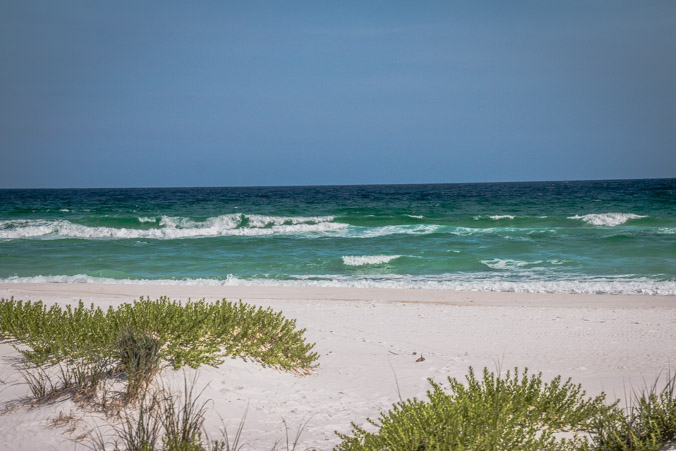
Bright and early the next morning, we set out to explore the area. First stop, Gulf Islands National Seashore and Fort Pickens.
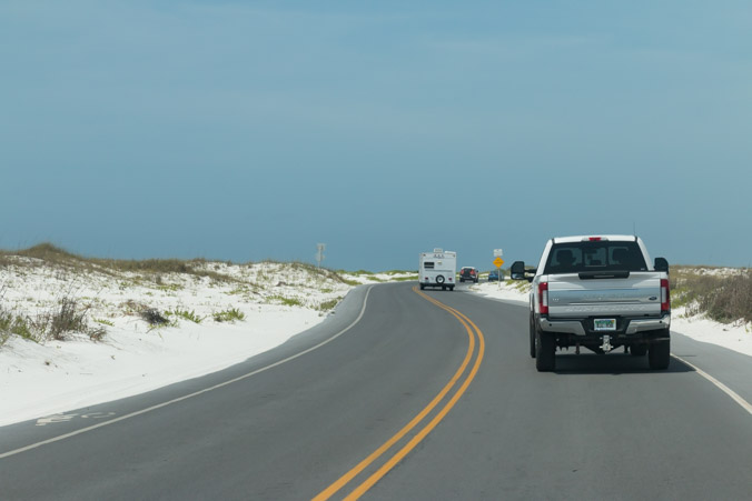
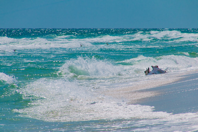
Jeff and I are from Southern California where the sand is a nice, healthy, beige color. Neither of us has ever seen sand so blindingly white. We learned later that the white sand is quartz, deposited here by erosion from the Appalachian Mountains.

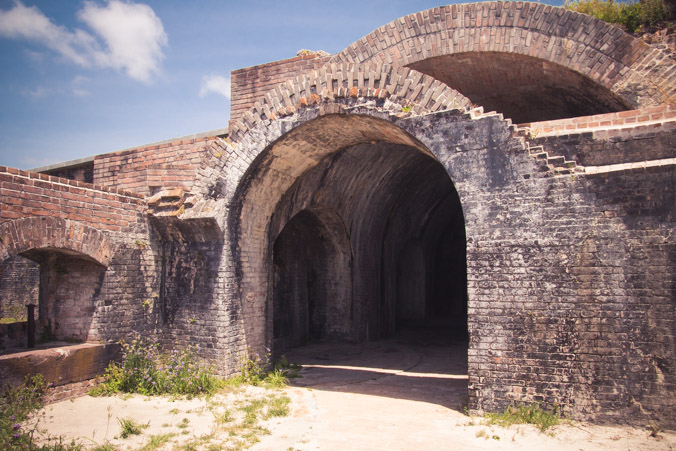
The approach to Fort Pickens looks suitably foreboding.
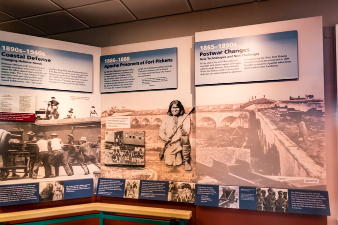
Fort Pickens sits at the westernmost tip of land near Pensacola Beach. Fort Pickens Road makes a loop around the edge of the peninsula, passing by the Fort Pickens Discovery Center, our first stop.
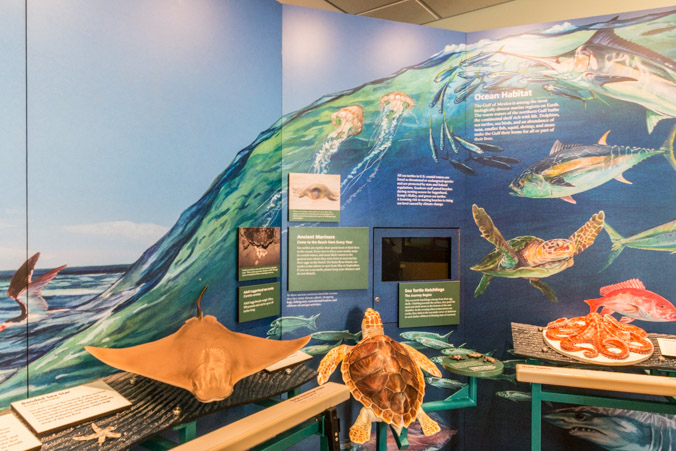
The Discovery Center has bright welcoming displays, outlining the history of the Fort, the land and the people. An interesting documentary plays on a loop near a little sitting area.
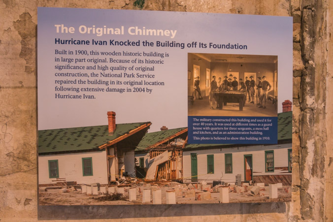
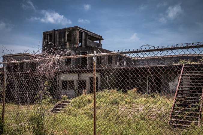
Fort Pickens was built in 1834 and has stood the test of time for the most part. The wooden building which houses the visitor center was built between 1900 and 1910. It hasn’t fared as well. In 2004 Hurricane Ivan knocked it from its foundation and flooded the building. The chimney below shows a line on the bricks which indicates the height of the floodwaters.

Fort Pickens has a very colorful history, it was built in 1834 and remained in service until 1947. 21.5 million bricks were used to build it and most of the construction was done by slaves. It was designed to defend Pensacola harbor but suffered a major fire in 1858.
By the time of Civil War, Fort Pickens had not been occupied since the Mexican American war and it was dilapidated. Despite it’s condition it was determined to be the most defensible post in the area. Around midnight, January 8th 1861, Lieutenant Adam J Seimmer and his guards fought off a group of local civilians who intended to occupy the fort. Some historians believe these may have been the first shots fired in the Civil War.
The Confederates attacked the fort on October 9th, 1861 with a thousand men but they were repelled by guns and artillery. They retreated with 90 casualties.
After tensions in Pensacola grew and the Confederates had secured posts at Fort McCree and Fort Barrancas, federal forces decided to shell the Confederate forts. That bombardment, a second bombardment and the battle of Mobile Bay left the confederates doubting their chances of success. The last Confederate soldier surrendered at Fort Pickens on May 10th, 1862.
Captives from the Indian Wars in the West were brought to Fort Pickens to be held as prisoners. In 1866 and 1867 Geronimo and several of his warriors were held here.
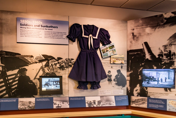
During the late 1890’s and 1900’s new designs of concrete batteries were installed at the fort. This was during a time of modernization known as the Endicott period. WWI and WWII brought even newer guns and more modifications. Little remains of that era as equipment was usually repurposed elsewhere.
After learning all we could, we opted to tour the fort on our own. As mentioned before, Fort Pickens Rd. loops to rejoin the main road. Exhibits and buildings are found along the way. The first stop is the sea wall where people enjoy fishing, biking and walking.
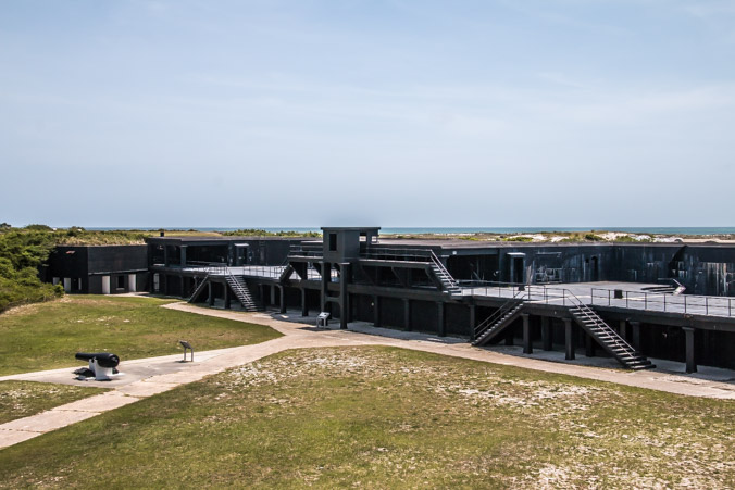
The road continues around to the newer batteries built in 1890-1910 during the Endicott period. In 1885 president Grover Cleveland appointed a joint military board headed by secretary of defense William Endicott, tasked with modernizing the existing outdated coastal defenses.
The batteries which appear along the loop road are Battery Trueman, Battery Payne, Battery Swearingen, Battery Seiver and Battery AMTB. AMTB is a WWII coastal gun mount with a 90 mm turret gun.
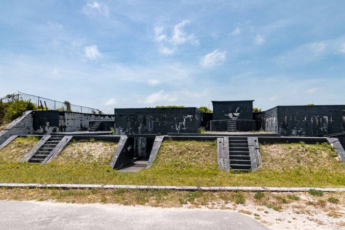
They can be toured but we’ve seen many of this type before and we’re anxious to see the original fort. There are many hidden batteries all over this stretch of land and it would be possible to take more than one day to walk around them all.
Battery Seiver is the largest of these batteries along the road, it faces the open sea and is the only one not refurbished for visitors. It looks very ominous, I wish it didn’t have to be fenced.
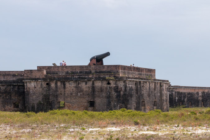
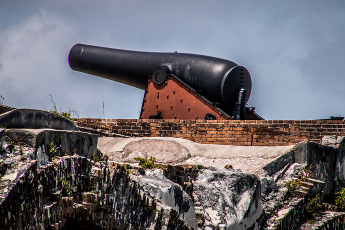
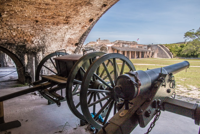
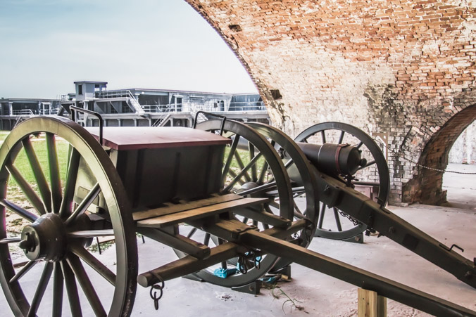
As the road turns back to the main fort, the cannon is visible on the outer wall.
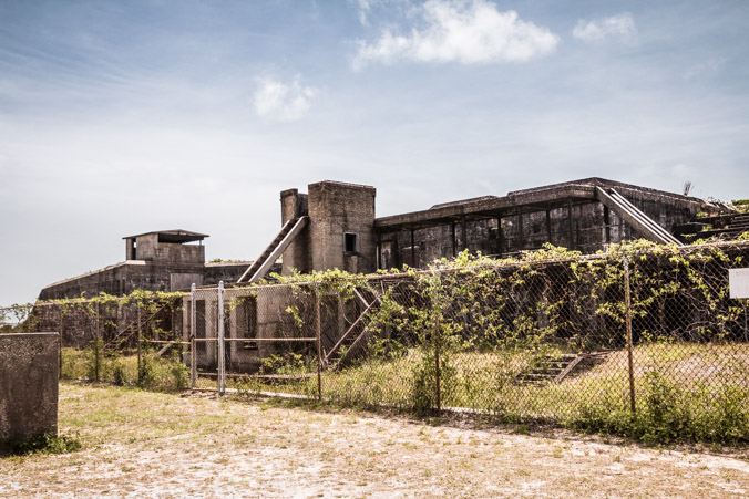
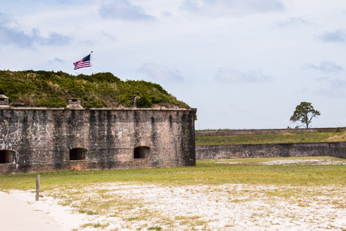
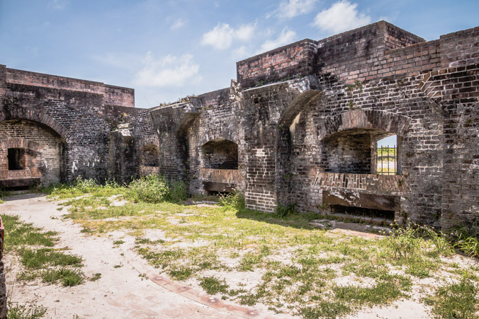
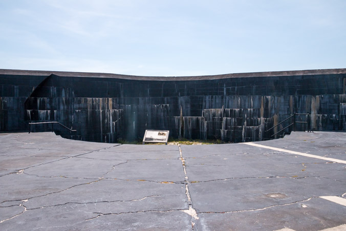
Approaching the fort from the parking lot, it’s difficult not to notice the edge of one wall which looks to have been destroyed.

On June 20th, 1899 a fire broke out in Fort Pickens Bastion D. The fire reached the Bastion’s magazine which contained 8000 lbs of powder. The resulting explosion killed one soldier and obliterated Bastion D. The force of the explosion was so great that bricks from Bastion D’s walls landed across the bay at Fort Barrancas more than 1.5 miles away. The damage was relatively confined to Bastion D but the foundations were torn away along with sections of the walls to allow for easier access to the batteries.
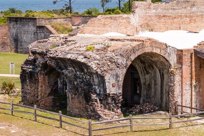
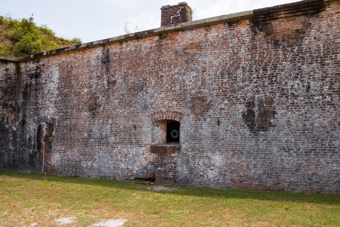
The picture above shows the opposite side of the Bastion D explosion and subsequent wall removal.

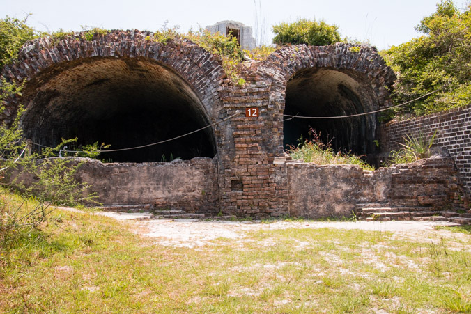
We walked around the fort, following numbered informational signs, stopping to listen to a docent lecture. We learned more about the structure and it’s defenses and saw some typical fort sights.


While I enjoy history, particularly military history and National Parks, I wanted to visit Fort Pickens for a very different reason.
I wanted to visit for the art.
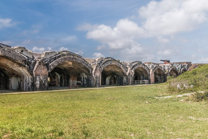
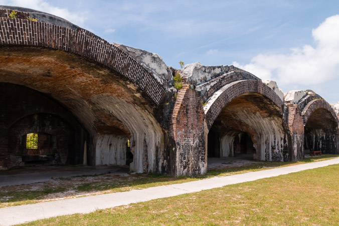
I had seen pictures of the architecture of the fort, the arches and passageways and while it was originally designed for the purpose of war, I can’t help but see the beauty left behind in the shell.
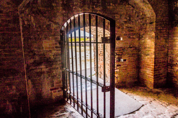
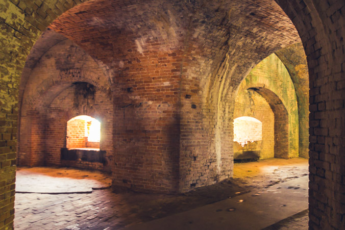
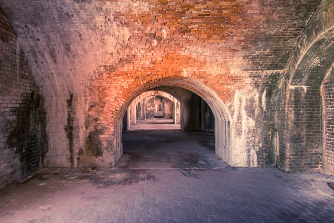
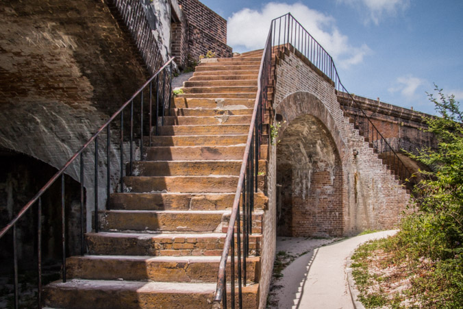
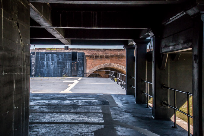
The deeper we go…
The more art is revealed…
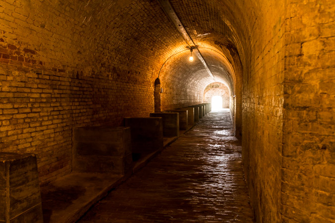
I mean how gorgeous is this supply tunnel?
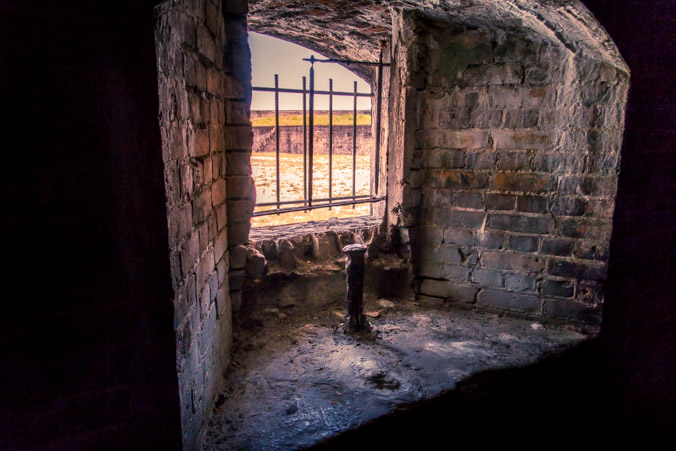
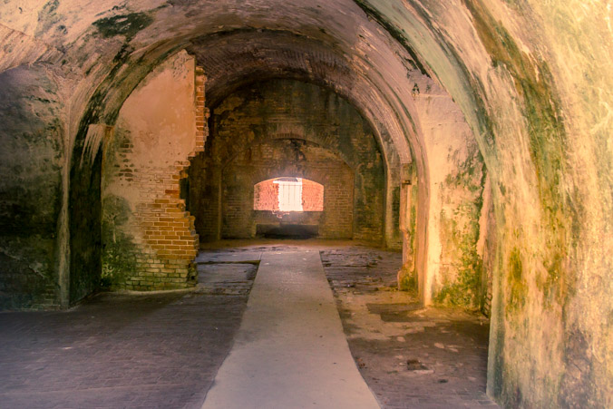
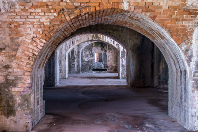
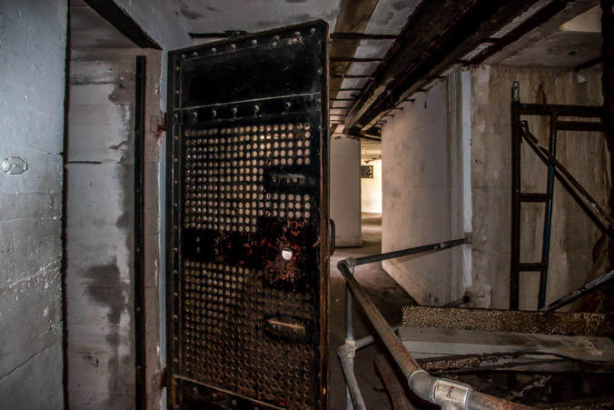
This opening leads to…
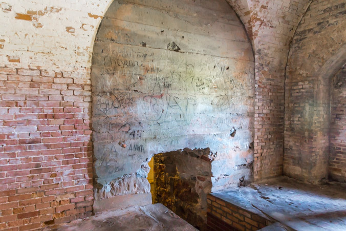
An older walled up magazine..

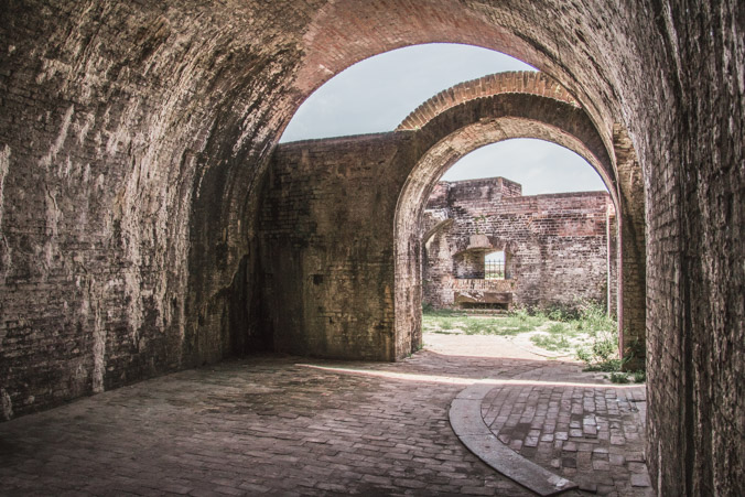
The tour sends us outside again for another view of the defensive walls.
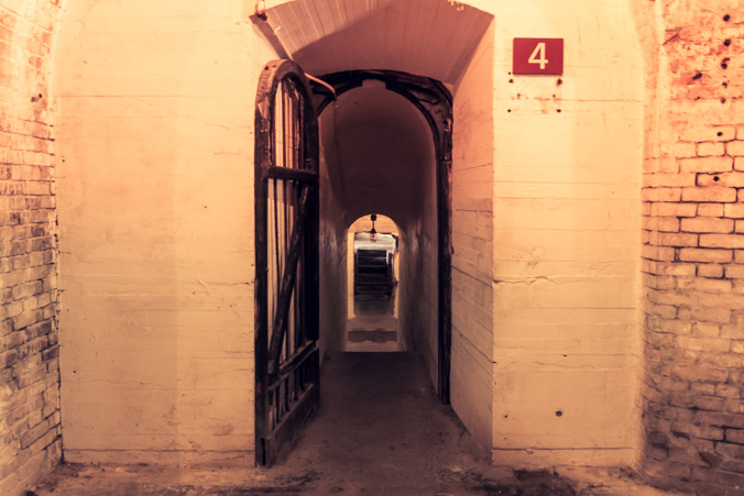
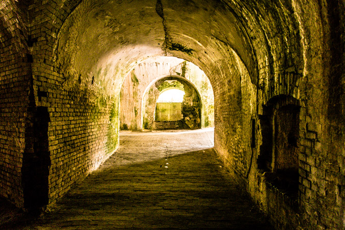
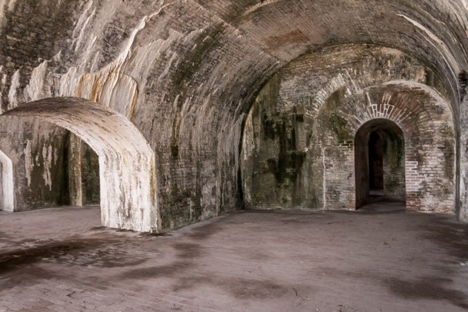
We follow the signs through room after room of various uses, each one a beautiful series of arches, lights and colors. I had a little fun with creative editing, I’ll let the pictures speak for themselves.
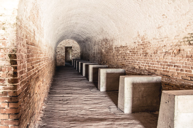


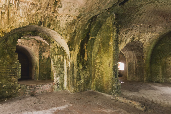
The powder storage rooms are like giant beehives.
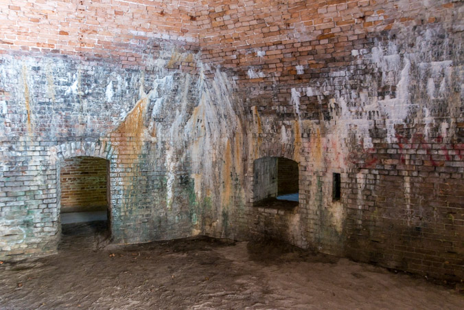
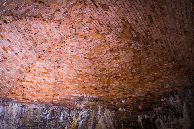
The ceiling is a pointed dome and the brickwork is magnificent.
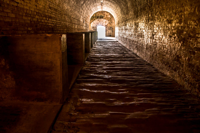
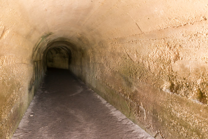
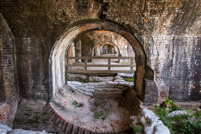
We find a secret tunnel through the fort.
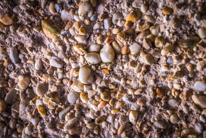
With walls made of pebbles.
Back outside again, this is a view of the arches.
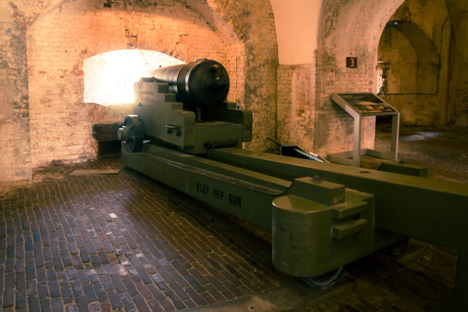
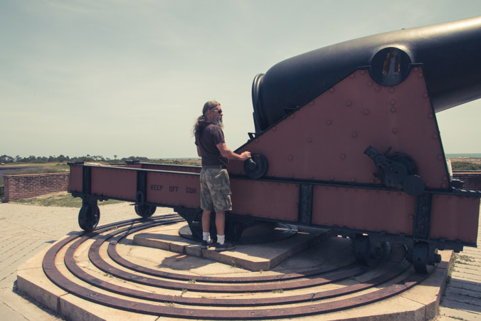
The cannon on the wall.
Cisterns provided the water for the fort.
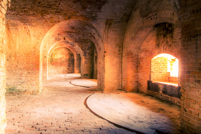
The arches close up.
Following the trail under the arches.

Back outside to a courtyard within the walls.
Looking back toward the interior, I cannot get enough of these shapes!
It’s like a cathedral.
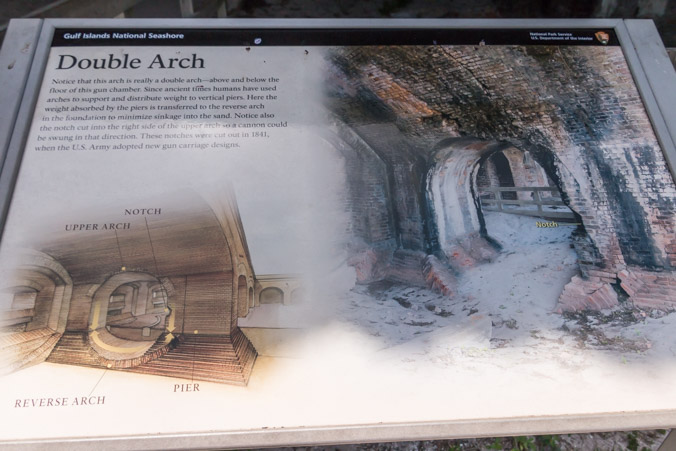
This interior section shows the construction methods used for the arches. They’re actually double arches which provide more strength.
Up the stairs to the outer wall.
We can see Battery Seiver from here.

There are a lot of unidentified foundations of previous buildings all over the area.

Jeff gets up close and personal with the cannon.
One of the batteries was built inside the walls.
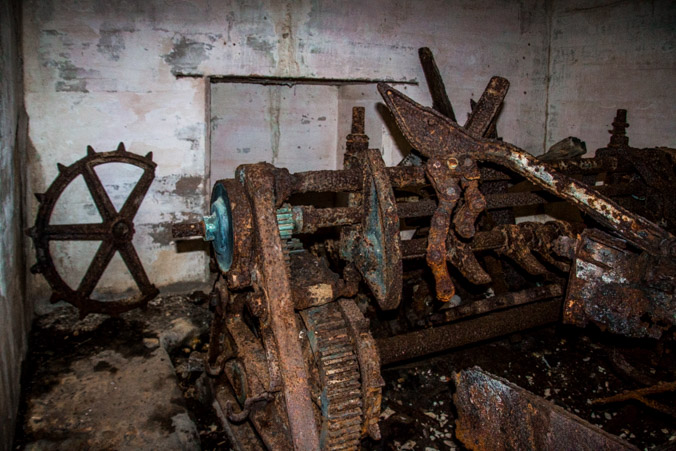
Time to explore. These types of batteries are always very dark and contain many small passageways. If you decide to enter one, make sure to have a flashlight. This one contained a few pieces of rusted machinery and ordinance lifts but not much else.


A cannon display on the way to the parking lot.
And a little corner nook caught my eye.

I’m sad to leave Fort Pickens, I could easily wander around all day waiting for the light to change, playing with angles and camera settings, but alas, we’re always on the move.
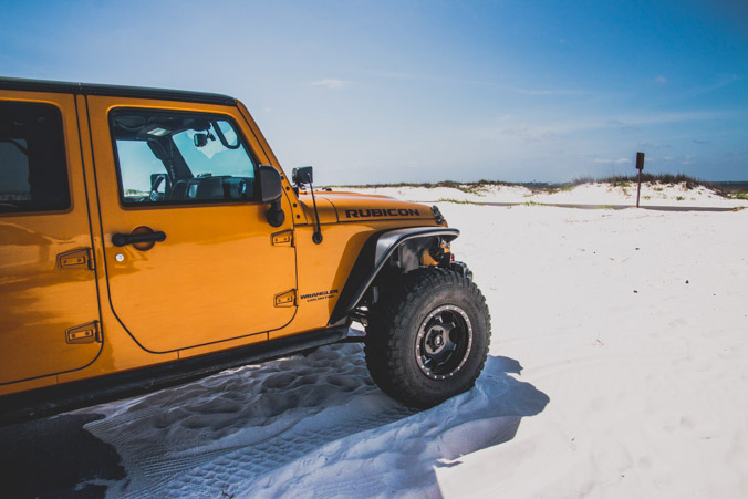
The loop I planned, takes us along highway 399, through Pensacola Beach and out toward Navarre Beach.
First sight, kites!,

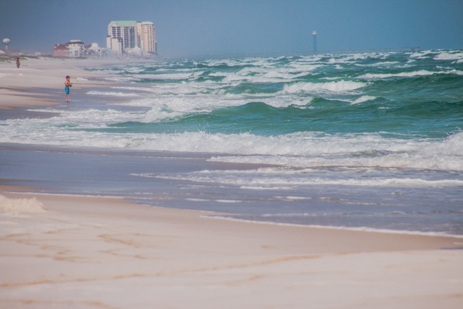
Periodically we stop to check out the beach.
I still can’t get over the colors!
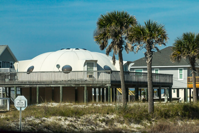
I neglected to mention the most important reason for driving this direction. To see the Futuro UFO House!
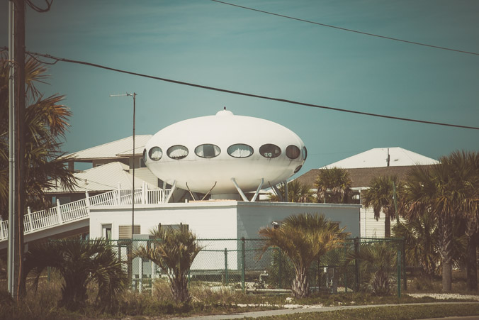
The UFO house is another bucket list item from my childhood.

The Futuro houses were prefabricated houses made in the late 1960’s to early 1970’s. Made out of fiberglas, they were designed as vacation homes to be taken apart and assembled on site. The idea never really caught on and fewer than 100 were made. I remember seeing them in magazines. Being the space buff I am, they always intrigued me.

There it is! Right outside my window!
A few more views of the scenery along the way.

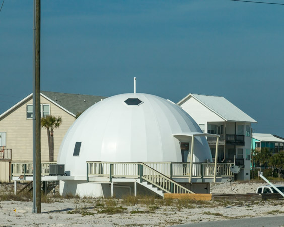
Apparently dome architecture is popular here.
At Navarre Beach, highway 399 turns inland where it joins up with highway 87. We’re driving north on highway 87 until it ends at highway 90. There’s one more stop on my itinerary.
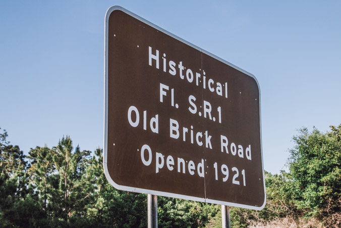
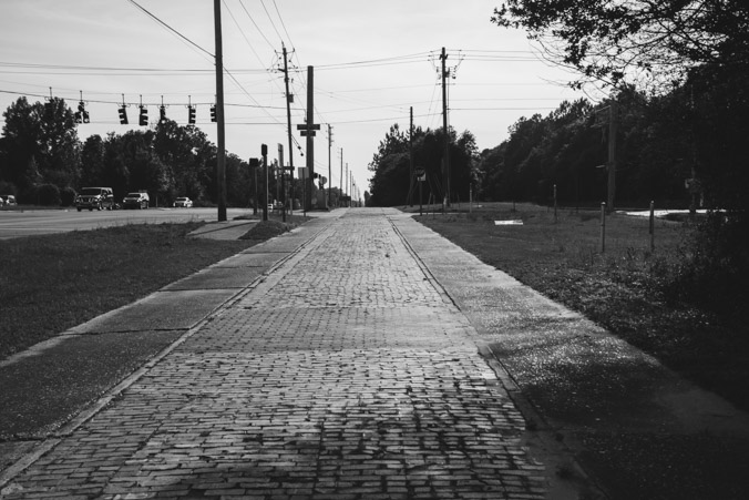
The Old Brick Road in Milton, Florida also known as the Old Spanish Trail, was an auto road that once spanned the United States from ocean to ocean. Promoters of the trail claimed it was the route used by Spanish conquistadors 400 years earlier but there was never a continuous trail in Spanish Conquistador times.
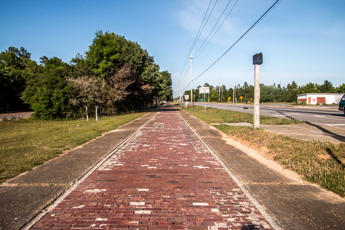
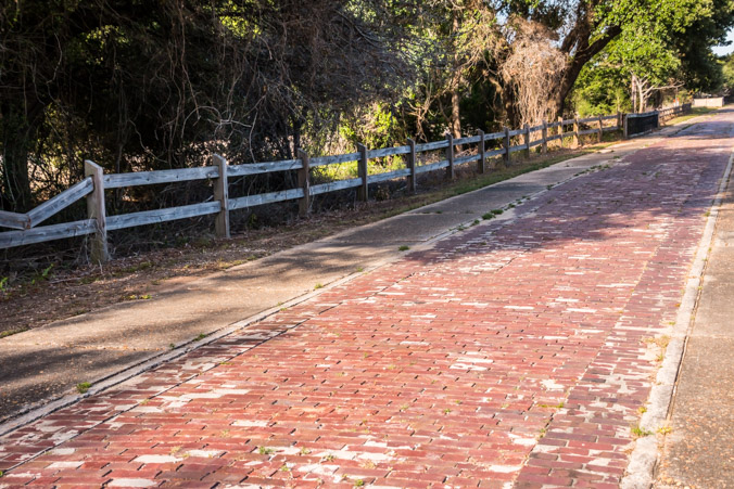
There is a present day association working to preserve the trail and the stories and history which go along with it.
Here’s wishing them much success!
See you down the road!

Enjoyed your photos and history of Fort Pickens. We were there in 2018 and yes, found it to be a photographer’s paradise.
LikeLiked by 1 person