
What’s big, round and hard as stone but has a teeny tiny surprise in the center?
Concretions!
I may have overreacted yesterday.
Pain will do that to you.
This morning the throat pain has subsided to a dull roar. Today is Saturday and I have NO desire to fight the crowd at Urgent Care, I’ll wait until Monday.
Time to check off an important bucket list item instead.
When Jeff and I were younger, I was constantly looking through 4WD books in search of places to go 4-wheeling. I found a place called The Pumpkin Patch, in Ocotillo Wells, where round rocks littered the ground as if it were really a Pumpkin Patch.
From that moment on, it was on my MUST see list. Unfortunately it was too far for a day drive.
Today it’s well within reach!
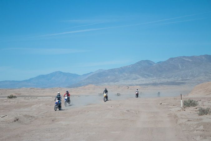
Ocotillo Wells is a VERY popular State Vehicular Recreation Area. There are miles and miles of trails, hills and washes to ride ATV’s. Dry camping is available in multiple locations and is often full of RV’s.
The entrance to the off-road area and ranger station is directly across the street from our RV park. Since we don’t know much about the region and maps are always helpful, we decide to stop in.
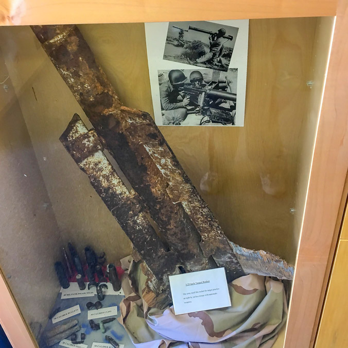
The little museum in the ranger station has exhibits of plants and animals but I immediately noticed a case containing bomb fragments and military artifacts. I knew there were many intriguing formations and geologic history here but I didn’t know how extensively the Wells area had been used for military target practice in the past.
Fragments of these practice bombs are still discovered to this day.
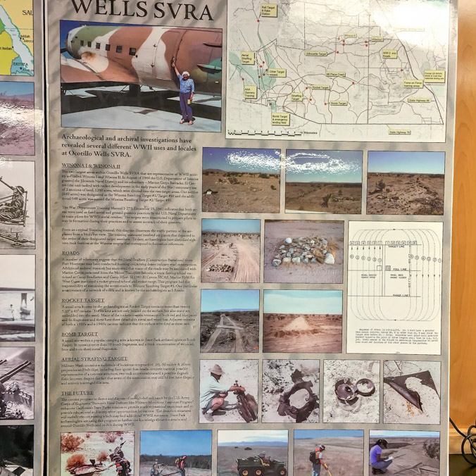

This map shows some of the historical sites.
I guess you never know what you might find in the desert!
Map in hand, we head out to start our own explorations.
The main trail, which leads out into the desert, is a roller coaster of “whoop-de-doos.” They come one after another, over and over. Those types of things don’t usually bother me but it’s making me nauseous.
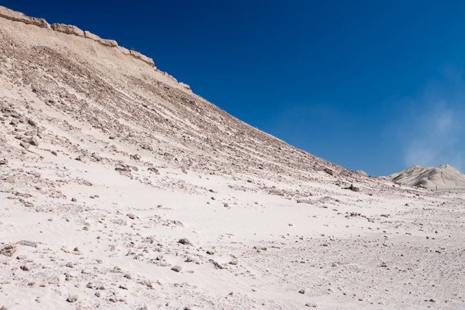
Our first stop is Shell Reef. The reef was pushed out of an ancient sea and is estimated to be 4 million years old. It’s not much to look at from far away but up close it’s a different story.
The sand around the base is covered with fossilized oyster shells that have broken off from the reef above.
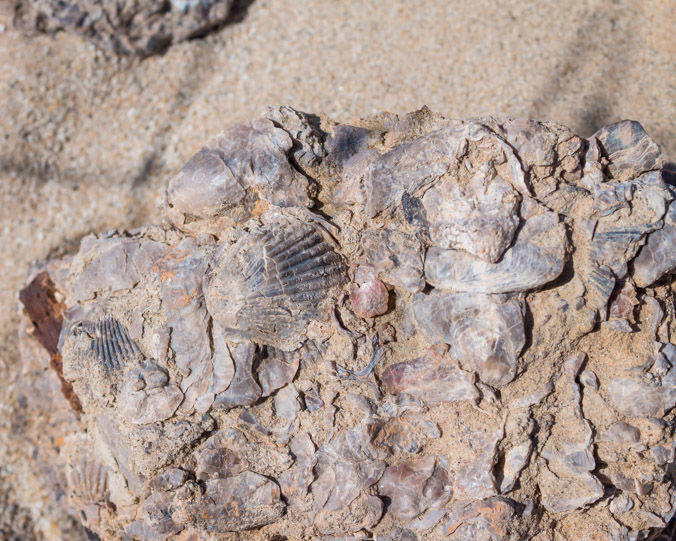
It’s absolutely fascinating to search the ground for the interesting formations. Each one is different. The reef is right next to the main trail and is protected by a small fence. Entry is through an open gate.
Please preserve this area for others to enjoy and leave fossils where they are.
The Main Road.
Shell Reef was great but The Pumpkin Patch awaits.
The internet warned that the path to the Patch may be tricky to find, signs are usually knocked down from the weather, off-roaders or both. We also have a little map which isn’t very detailed.
As we start out though, the signs are clear and visible.
Motorcycles and other vehicles have criss-crossed all over the place and as the trail climbs through a rocky area the path is less clear, the signs non-existent. We question the direction a few times. Either it’s a lot further than I thought or I’m sick and tired of bouncing around.
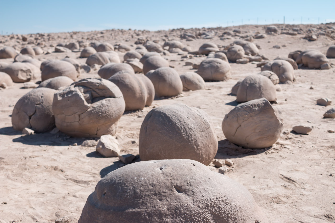
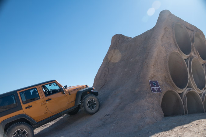
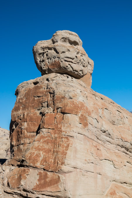
Finally we start to notice some round looking rocks in the canyons and gullies next to the road and at last the road ends at a plateau and parking area.
There it is! The Pumpkin Patch!
Here’s an internet description of the process that formed the pumpkins.
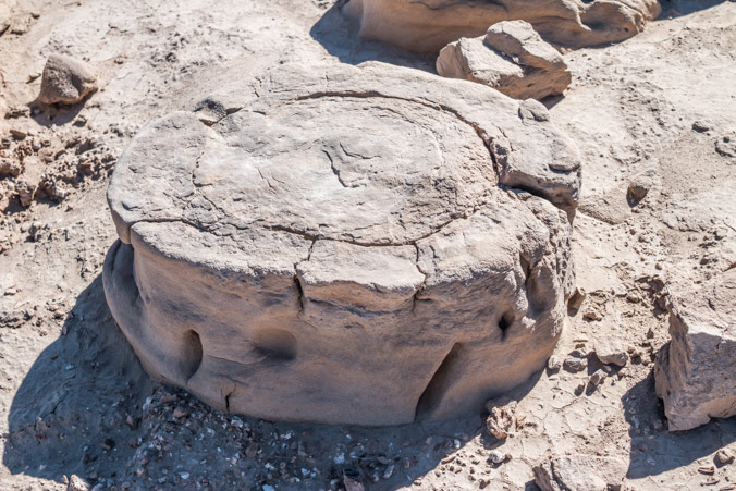
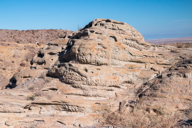
This unique landscape is the result of wind and water continuously eroding the surface soil and revealing these globular sandstone concretions. Such concretions are believed to be formed by the natural cementing of sand particles to a small object such as a piece of shell, a grain of sand, or even an insect. Please help preserve the Pumpkin Patch and the nearby ridges where new pumpkin-size desert “pearls” are emerging.
I’ve waited twenty plus years to see this. Here are my impressions.
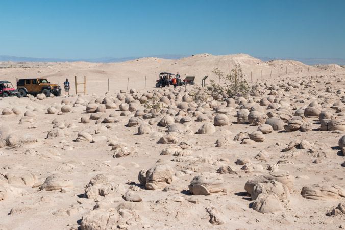
- The pumpkins are enclosed by a rail fence (I thought they were out in the open) and it’s blistering hot even in February.
- The “field” that I’ve seen so many pictures of over the years, is much smaller than I thought.
- Many of the “Pumpkins” are not “balls” but are unique shapes.
A tinker toy!
As remote as it is, it’s VERY crowded with families on ATV’s. I’m happy to see parents share the beauty of the desert with their kids.
- It was a thrill to see and I finally got pictures!
We bid farewell to the Patch.
After consulting the map we decided to continue across the desert and intersect with paved road S22 which connects Borrego Springs with the Salton Sea. That will give us two options of directional travel.
But what’s that strange structure in the middle of the desert?
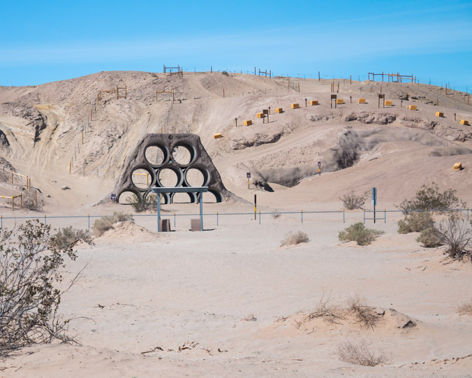
Time to investigate.
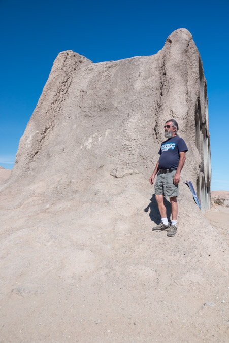
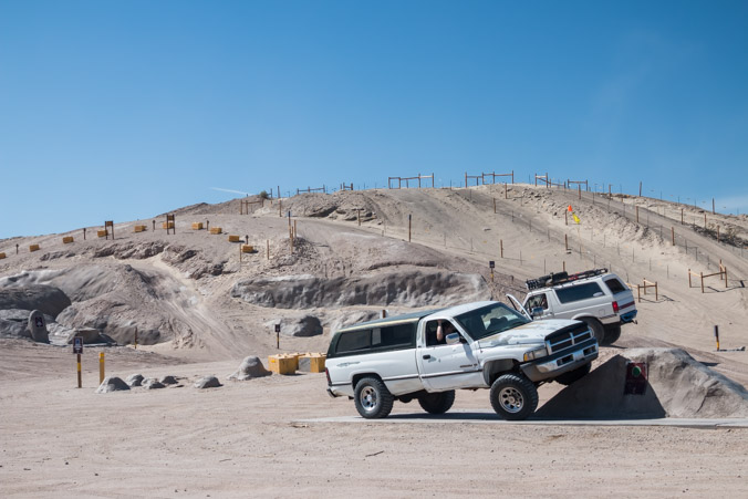
It looks like we’ve stumbled upon Truckhaven 4×4 training area.

Lots of obstacles to try.
Since climbing was not the plan for the day, we satisfy ourselves with a little posing.
Both Man and Machine.
Nope!
There were a few other people wandering around but no one was playing until we started it!

This guy ALMOST tipped over multiple times.
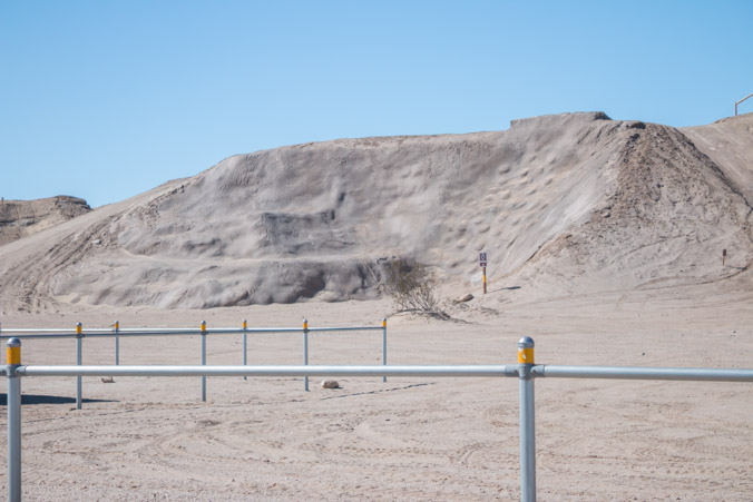
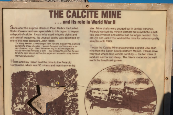
We’d had enough fooling around for the day and exited the area onto S22. The map showed a calcite mine right up the road so we went over there.
Calcite was mined here during WWII for use in bomb sights.
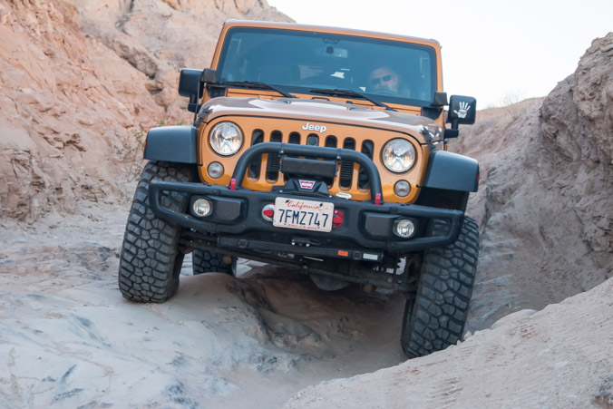
The road to the mine was very rough with a lot of sideways tilting, Jeff wasn’t concerned but it seems to me that every time the Jeep tilts, it’s toward my side and leaves ME hanging over an abyss!
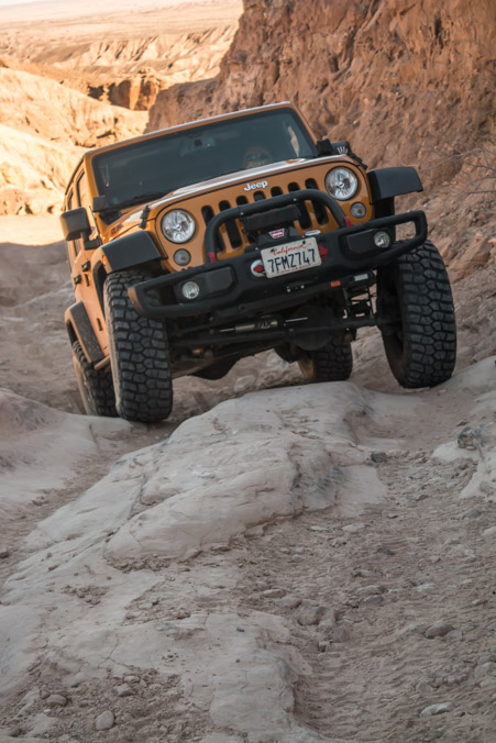
Tipping over backward is not my idea of fun either!
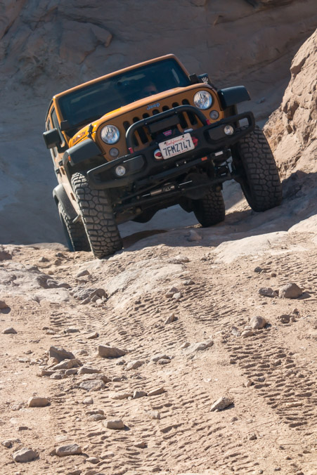
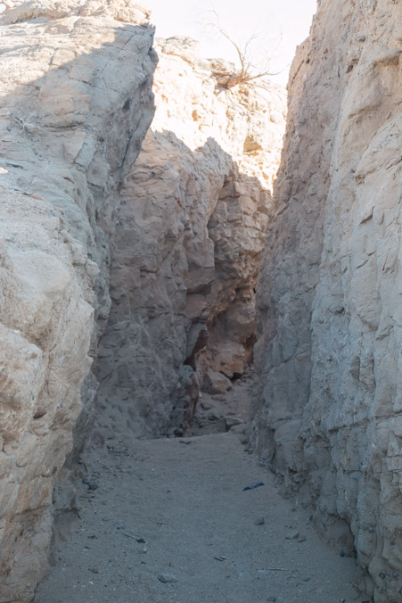
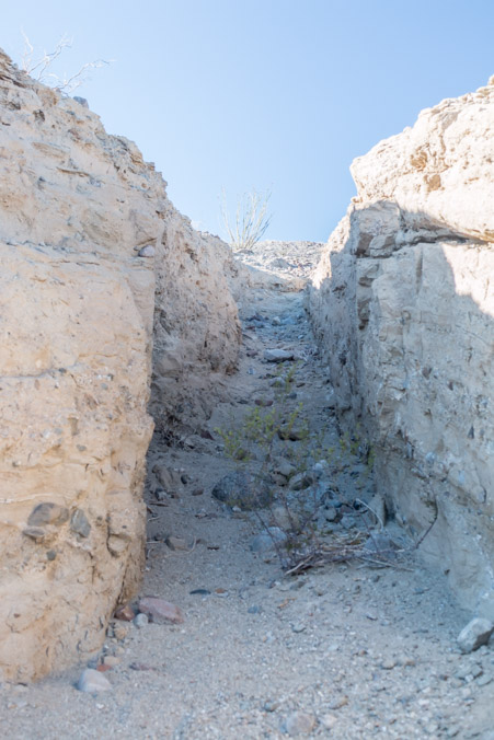
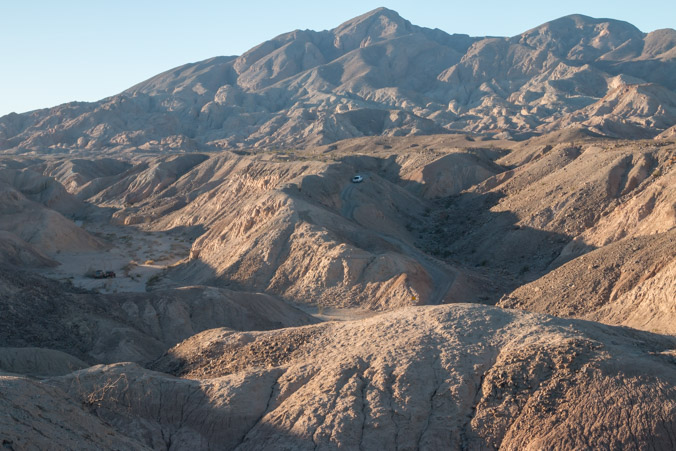
There are beautiful rock formations and slot canyons all along the road and many people hike instead of drive.
At the top, the mines themselves are trenches and not shafts.
Once you see one it’s easy to notice them everywhere.
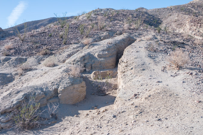
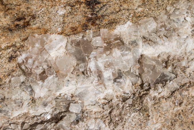
This must be Calcite.
The views are incredible!
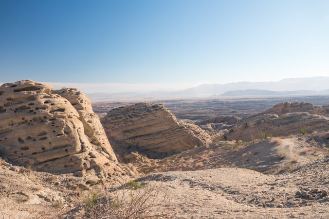
Looking back the way we came.
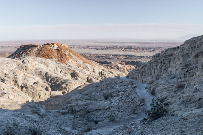
What goes up must come down.
Another brave explorer attempts the road.
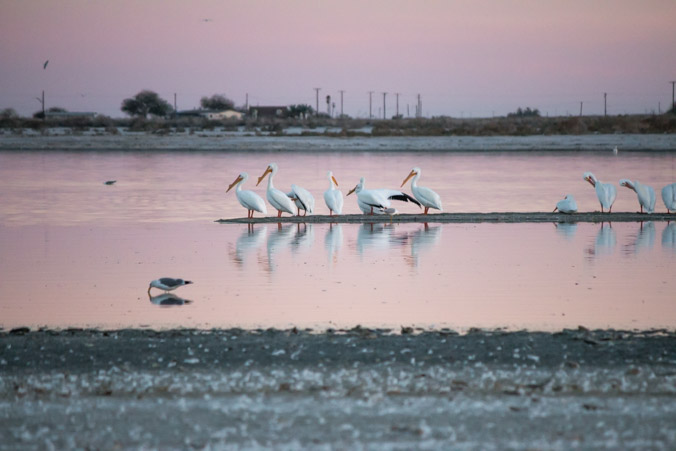
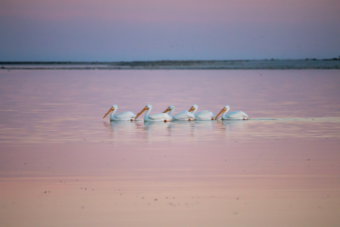
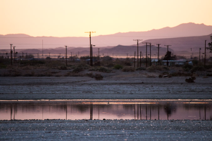
All this exploring has made Ampy the Jeep very thirsty. There are very few places to gas up out here so it’s necessary to go back toward the Salton Sea. We wanted to look around the old Yacht Club anyway.
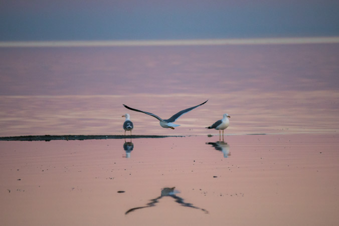
After gassing up, we drive around looking for a scenic spot to get out and find an open area with a lot of “beach” near the Yacht Club. When I open the door, the fish smell hits me. It’s definitely stronger than it was at Bombay Beach but I don’t care because the views are spectacular!
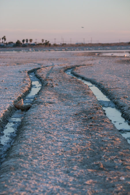
The ground is not sand, but billions of bone fragments of dead fish. In places it feels almost like quick sand. Watch where you step.
Don’t even think about driving on it!
Unfortunately my camera has been acting up all day and my pictures are suffering but are you kidding me with these colors????
The colors actually look like this!
Seriously one of the most unique places on Earth!
