Thirteen years ago, Hurricane Katrina set into motion a series of events that resulted in the deaths of 1,800 people. Levees broke, the city was inundated and inefficient bureaucracy crippled relief efforts.
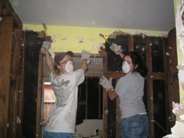
When the storm was over and the waters receded, volunteers from all over the country descended on the area, determined to help the city and it’s people rebuild. Our daughter, Laura, was one of those volunteers.
In 2004, our family took a road trip which included a stop in New Orleans. We enjoyed a narrated carriage ride, walked the French Quarter, went to Mardi Gras World and visited the plantations along the River Road. One year later, on August 23rd, 2005, Hurricane Katrina brought devastation to the city. It wasn’t until the summer of 2006, that volunteers, were allowed to help clean out homes.
Simpson University in Redding, California sent a group of it’s students to help and Laura went along.
A few of her pictures from this volunteer trip.
")
")
")
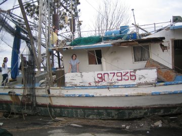
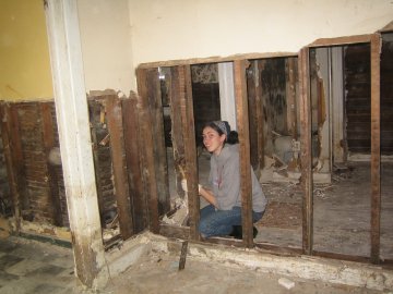
Every house needed to be completely gutted. The oil and chemicals which polluted the waters had contaminated the buildings. The college students worked hard, cleaning out one house at a time. Later, they made a second trip bringing in food and donations.
Laura wanted so desperately to help where she could. She shared her love of the people and the city with us often. When we finally had a chance to visit again we were hoping to share with her how the city had recovered. It was also important to us to be able to pay our respects to those who were lost.
Today, I’ve mapped out a driving trip through some of the most devastated areas as well as National Parks and tourist spots.
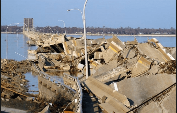
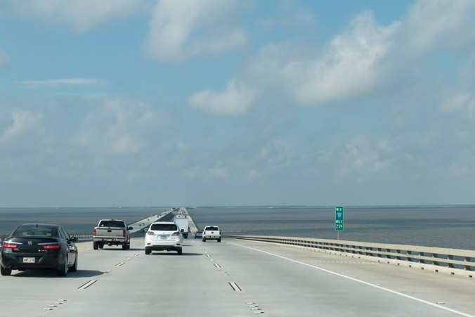
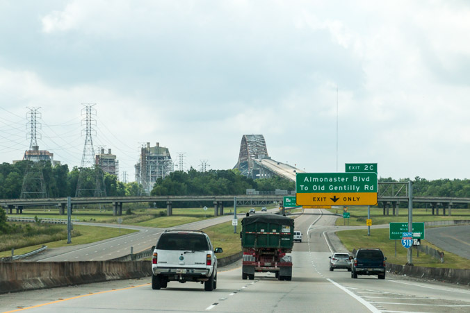
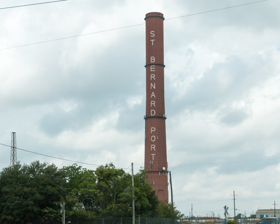
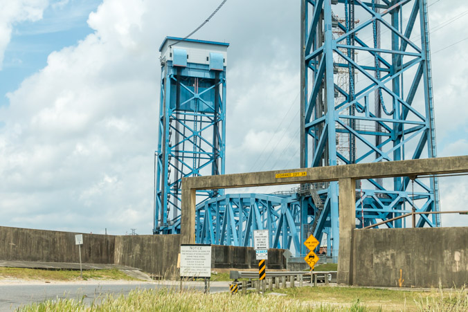
We’re staying in Pass Christian Mississippi. Our route takes us across the I-10 twin span bridge, over the bay of Lake Pontchartrain.
The I-10 bridge was heavily damaged after Katrina (photographer unknown).
This is our view of it today, a beautiful new roadway.
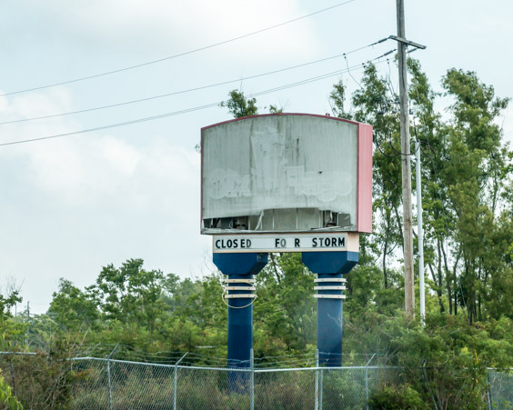
One of the first things I wanted to see was whether Six Flags New Orleans was still there. I heard rumors that some of it had been dismantled.
As we approach, it’s clear the park is still abandoned and the rides remain. The skeleton of the roller coaster is visible from the freeway.
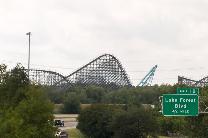
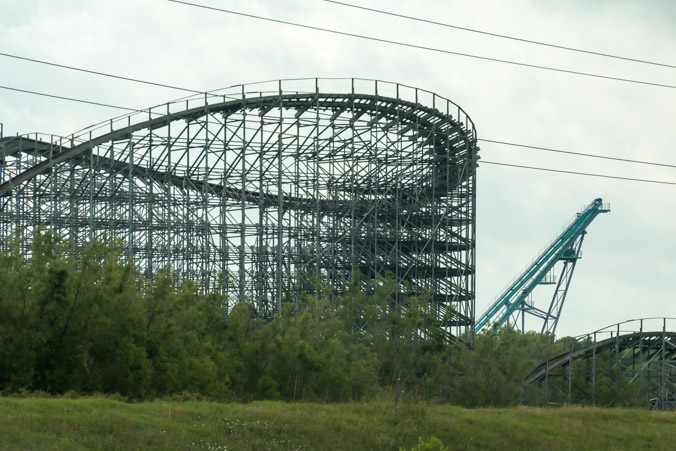
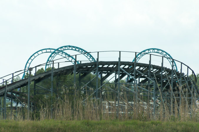
From a distance, you can almost believe the park is still operating. Once you turn onto Six Flags Parkway though, the illusion is shattered.
The storm sign still stands thirteen years later.
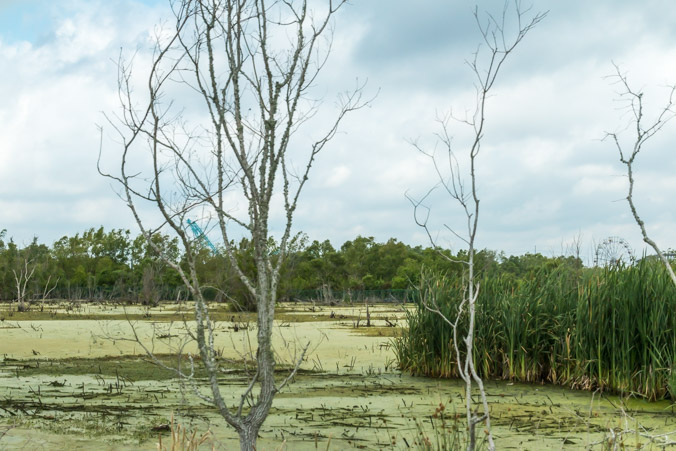
The parking lot is around the back of the park. The entrance is guarded by a security vehicle. The back landscape is a swamp, the ghostly ferris wheel visible in the distance.
Another loop around the front and the ferris wheel comes into view.
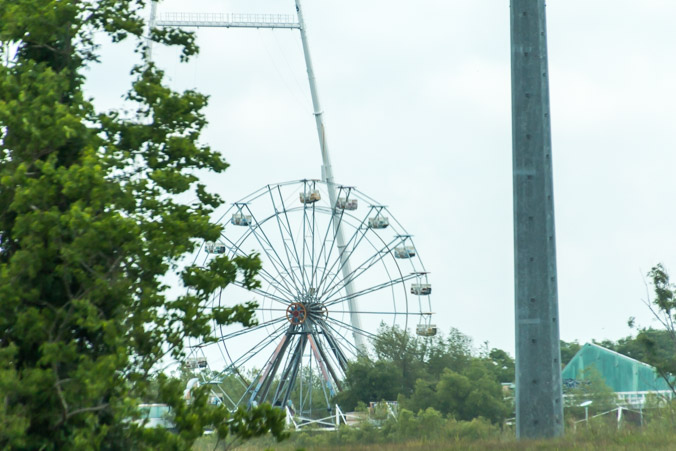
As of June of this year, the new mayor has been given one year in order to try and find redevelopment for the property. This article link explains the agreement and shows some incredible drone footage of the park.
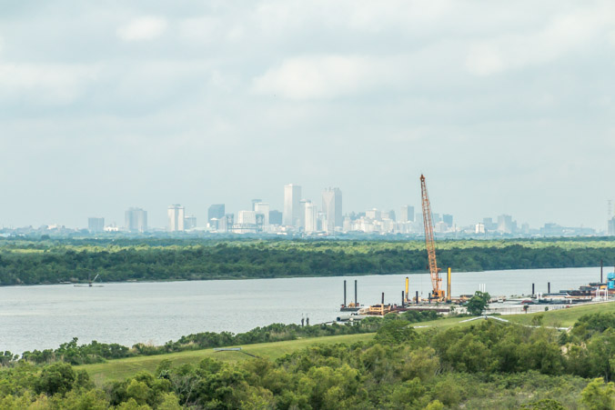
Our tour continues down highway 510 to 47 into Chalmette and a steep bridge.
With an incredible view of the city.
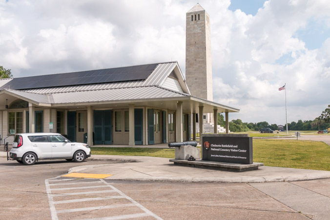
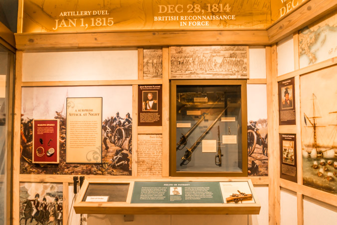
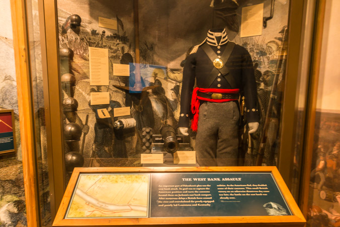
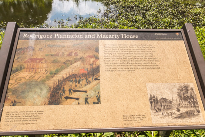
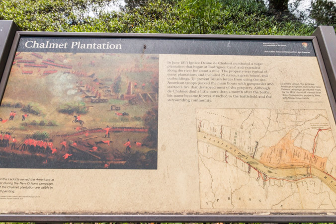
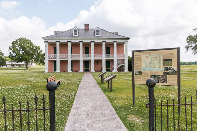
Our next stop is Chalmette National Cemetery and Battlefield. This is a National Park Passport stamp site and we’re anxious to see how it has fared since Katrina.
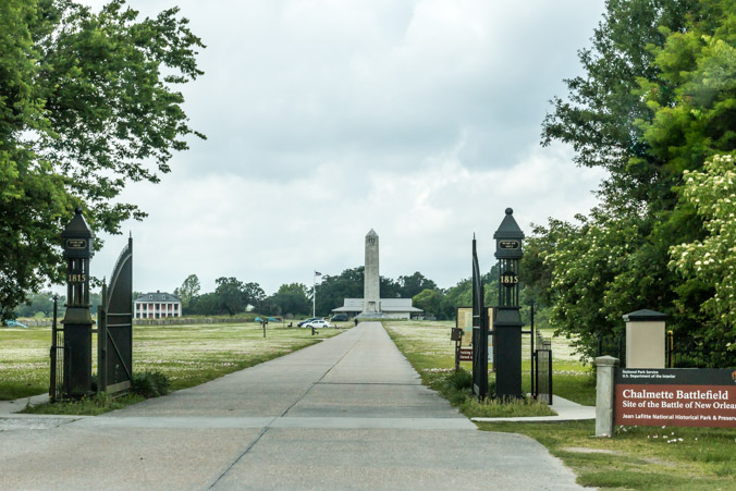
The damage to this park was severe. The visitor center was completely destroyed, the historic cemetery wall was heavily damaged and coffins and soldiers bones surfaced in the flood waters.
Today there is a brand new visitor center, full of artifacts and information about the Battle of New Orleans.
Chalmette battlefield is the site of the last great battle of the war of 1812, also known as the battle of New Orleans. On January 8, 1815, Andrew Jackson’s hastily assembled army won the day, against a battle hardened and numerically superior British force. Americans took great pride in the victory and for decades celebrated January 8th as a national holiday.
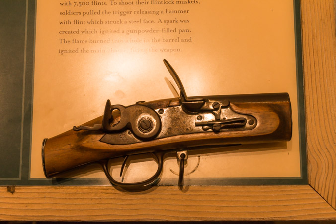
Can you shoot a musket?
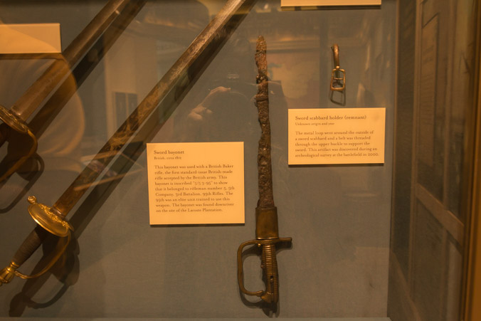
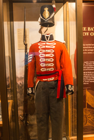
Battlefield artifacts.
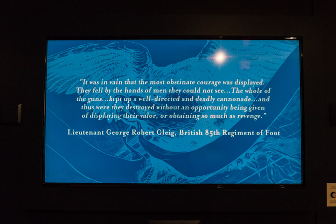
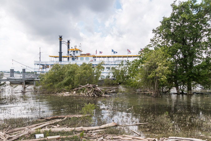
The visitor center provided an interesting docent lecture on the lawn. We were joined by a group of passengers from a New Orleans paddlewheel cruise.
The docent told how Jacksons army of rag-tag, backwoods sharpshooters, free men of color and swashbuckling buccaneers, won the battle using earthworks, canals and other defenses.
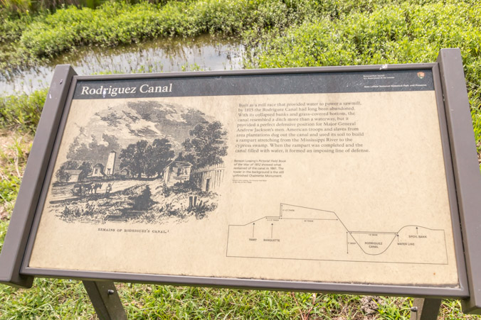
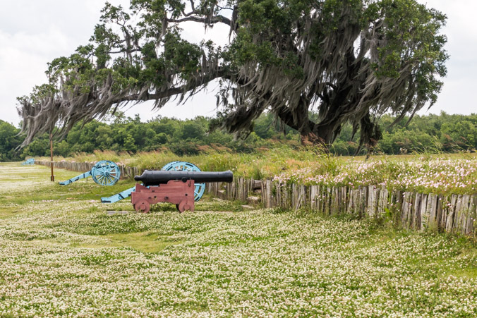
The battlefield itself is a large expanse of open land. There is a driving loop of the battlefield but we are pressed for time today and opt out.
The cemetery can also be toured.
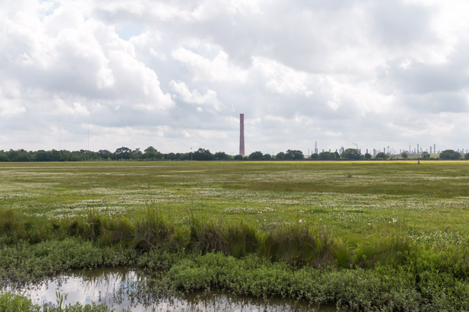
The land was originally a plantation.
There is one building remaining, right on the banks of the Mississippi.
The Malus-Beauregard House. The interior of the house was flooded 2-3 feet during Katrina. We were told it has been restored but is currently closed.
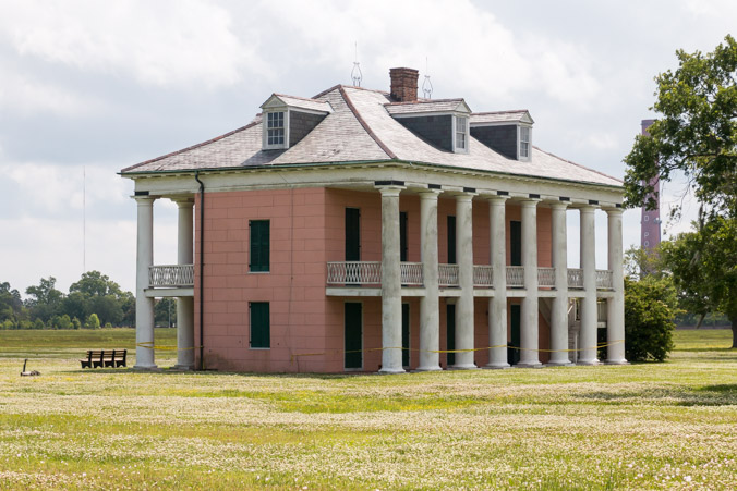
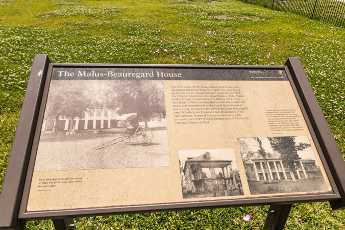
The house faces the Mississippi and the paddlewheel boat parks at the dock there. Periodically, huge cargo ships cruise by while blowing their horns.
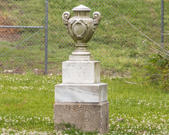
Hidden away, in the far corner of the land, is a small memorial marker.
It says “In memory of Samuel Spotts, the man who shot the first gun at the battle of New Orleans.”
It’s been an interesting visit but it’s time to move on to the next destination.
A drive through the Lower Ninth Ward.
We did’t make it very far before traffic was stopped for some police action.
Their guns are drawn.
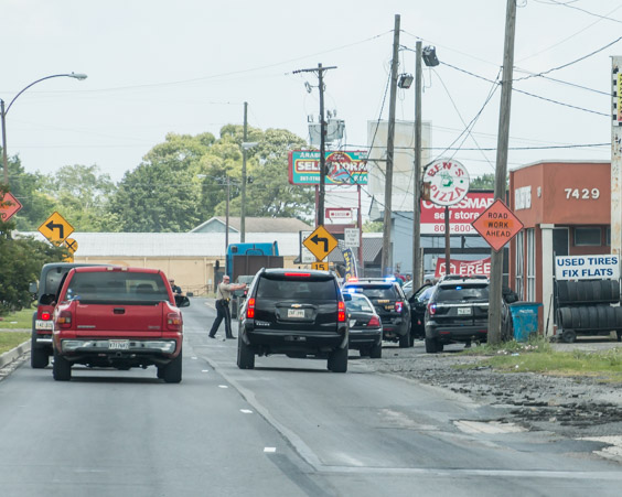
I’m astounded at the number of people nearby, casually watching.
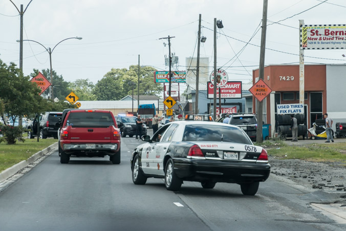
There are no less than two guns drawn, possibly multiple suspects but the matter is resolved quickly and traffic flow resumes. Crime is alive and well here.
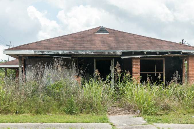
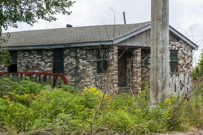
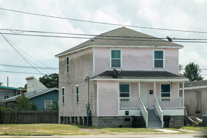
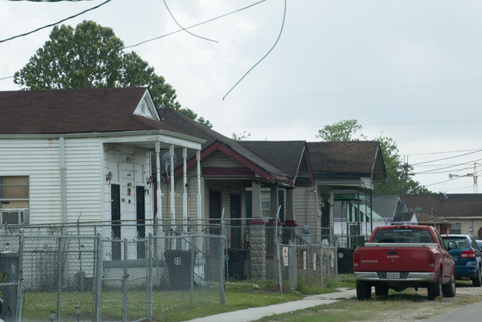
As we enter the Lower Ninth Ward, it’s a ghost town. There are hundreds of empty lots where houses once stood, and many derelict houses which still show damage.

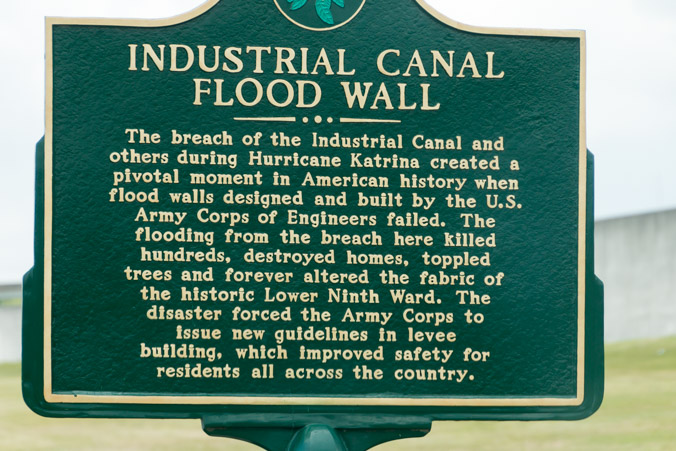
As we approach the upper corner of the neighborhood, we see levees, pump houses and pipes. This is the first time I’ve seen the technology and infrastructure which keeps the water out of the bowl that is New Orleans.
It’s a huge undertaking.
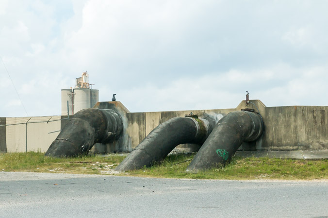
Seeing it in person has given me a new appreciation for the complexity of the job.
This sign marks the spot where the first levee failed in the Lower Ninth Ward.
My heart breaks for the people who lived through this nightmare.
The high water marks can still be seen on some of the houses.
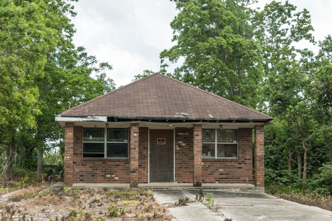
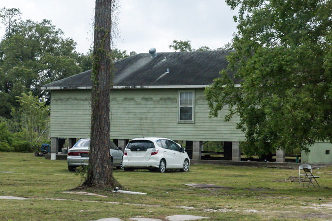
After Hurricane Katrina, actor Brad Pitt built dozens of new homes for residents of the Lower Ninth Ward. He operated under the umbrella of an organization called Make it Right Foundation. In the beginning, there were complaints that the modern house styles didn’t fit in with the historical styles of New Orleans. Years later, there were complaints that the houses were built cheaply and they are now falling apart.
I saw quite a few that had a lot of damage and I was surprised to find out that they were the new houses, not the old. These two are a little better than most.

They definitely don’t fit into the style of the neighborhood.
When planning this driving tour, I was using Google maps, satellite view. During one of my “spying” sessions, I noticed a huge building near the river whose roof seemed to be damaged. I discovered in my research that the building was the Holy Cross School built in 1895. It was a beautiful building and like so many others I was afraid it might be demolished.
I wanted to see it before it was lost.
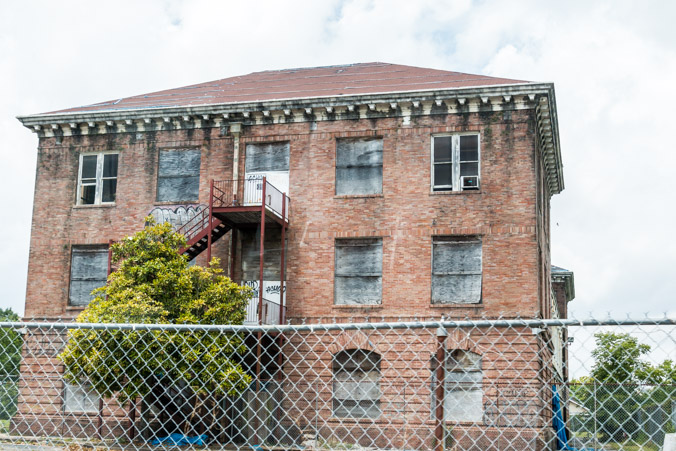
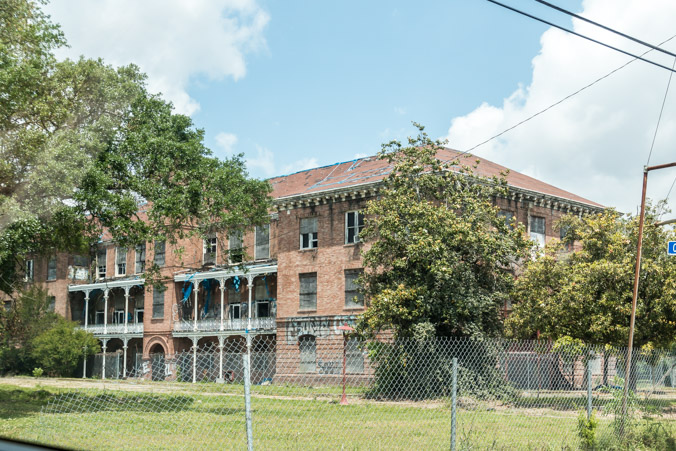
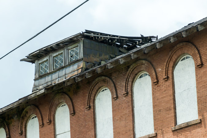
It suffered extensive damage during the hurricane and has been allowed to deteriorate. It’s beautiful Italianate architecture is marred by graffiti, weeds and old pieces of tarp. There is talk of a redevelopment project for the building and a neighborhood association seeks to protect it. It’s discouraging to note that nothing has been done to save it in 13 years time. There is one, small, encouraging sight though. When I looked at recent satellite images, a brand new tarp is covering the roof now.
Around the corner stands another old, neglected building,
The Thomas J Semmes school, dedicated in 1901.
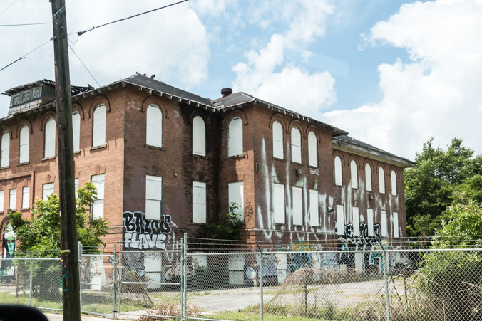
It’s also covered in graffiti but seems to have been recently boarded up. I can’t find much information about the building except that it was scheduled to be auctioned by the Sheriffs department in April 2017. The sale was postponed and I found no information on the sale. I did, however, find an old article, involving a politician who illegally diverted FEMA funds in 2012. Funds which were earmarked to refurbish the building.
The political corruption and ineptitude during and after this disaster, are so outrageous as to be almost unbelievable. If you want to learn more, I highly recommend the book “The Great Deluge” by Douglas Brinkley.
It will break your heart.
So far, we’ve seen a lot of lingering damage.
One of the most shocking sights was a complete storage facility with doors popped open, ruined belongings spilling out. It still sits there 13 years later. Did the owner just walk away from it? Who owns it and who’s responsible for cleaning it up?
We saw lot, after lot, after lot, of smashed cars which were salvaged from the waters. I’ve never seen so many smashed cars. I guess it never occurred to me how many cars would be lost in a disaster like Katrina. What do you do with all of them? They’re still sitting in towering piles scattered around the city.
Rust, graffiti, mold and trash. In this part of town, so much was lost. Homes were destroyed, people died or moved away, never to return. There are a few pockets of hope, people hanging on, trying to bring life back to the neighborhood. We saw a houses being refurbished, new siding, new paint, flowers planted in boxes. Businesses are open and life goes on. It may never be the same, but I hope that the residents can make a good life there again.
This ends part one of our New Orleans tour.
Stay tuned for part two!
