
The United States is chock full of National Monuments, Parks and Memorials and yet most of us don’t even know they exist. Natural wonders, historical sites and simple beauty are just waiting to be enjoyed, cherished and explored.
Chiricahua National Monument is known as the “Wonderland of Rocks”.
A wonderland neither one of us had ever heard of.
When Jeff and I started our journey of retirement via RV and Jeep, we decided to purchase a National Parks Passport Book. We now plan trips around Parks with stamp cancellation stations. Doing this has forced us to consider visiting places we might ordinarily pass by.
We’re currently camped right in the middle of several national park locations, though it’s a long drive to get to some of them. Chiricahua is 81 miles away. It’s possible to camp in towns that are a little closer. Camping is also available by reservation inside the park but the roads are narrow and there are size restrictions.
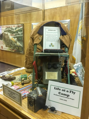
Chiricahua is an older park, most of the trails and structures (including the visitor center) were built in the 1930’s by the Civilian Conservation Corps. The center has a wonderful display telling the history of the Corps. Some fascinating facts about the Corps: They had several nicknames, Roosevelts Tree Army, Colossal College of Calluses, Woodpecker Warriors and others. Many young men joined the Corps because even though the work was hard, they were guaranteed three square meals a day at a time when meals were hard to come by.
There was so much interesting information in the museum. An eight minute movie explains the history of the park and surrounding area as well, but for us it’s time to get out and explore.
The “must do” activity is an 8 mile scenic drive through the park.
Less than a mile in, the rock formations peak through the trees, teasing us and leaving us wanting more.


The road rises steeply, it’s very narrow and curvy, the way you’d expect a road built in the 1930’s to be.
Massai point sits perched at the end of the road 6870 feet above sea level.
This is the view spread out below.


Massai point has a funny story about it’s name.

An exhibit building sits above everything.

The views from the building are breathtaking and the exhibits inside explain the geology of the area and how the pinnacles were formed.
This is the view of the other side.

The strange mountain in the distance has a unique story.

The entire Wonderland of Rocks owes it’s existence to the Turkey Creek Caldera. In The Cenozoic era the volcano erupted, expelling around 100 cubic miles of magma. Pyroclastic flows of hot ash and pumice were laid down over a 1,200 square mile region that eventually cooled into rhyolitic tuff. The volume of material was so great that the magma chamber collapsed and formed the Turkey Creek Caldera. It’s estimated that the eruption was one thousand times greater than the 1980 eruption of Mount St. Helens. It is this rhyolitic tuff that has eroded over the years forming such fantastic shapes.

Continuing our walk around the scenic loop brings us to another notable rock formation known as Cochise Head, named after the famous Apache chief.


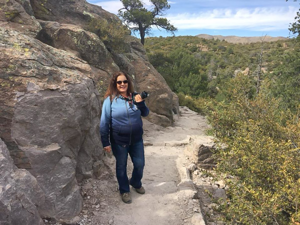
A rugged loop trail which leads out to the CCC overlook sits at the opposite end of the parking lot. The trail provides an unhindered view into the valley as you approach the rock structure.

What a crazy engineering feat!

It’s carefully outfitted with an old fashioned tube telescope which points toward individual formations.


The trail continues along the cliff edge.

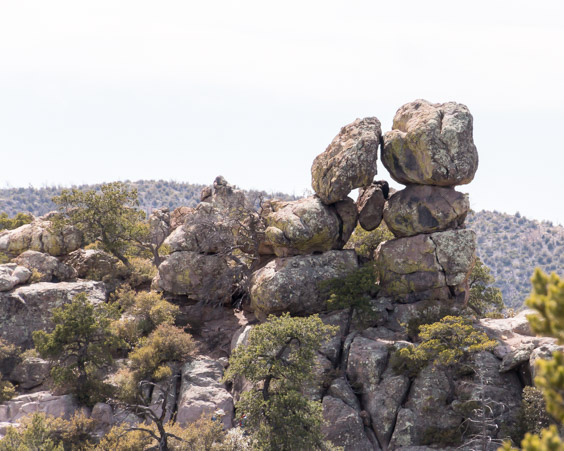
And leads to Balancing Rock, which is absolutely massive.

It’s hard to get a close picture without scrambling down a slippery slope.

Which Jeff did…

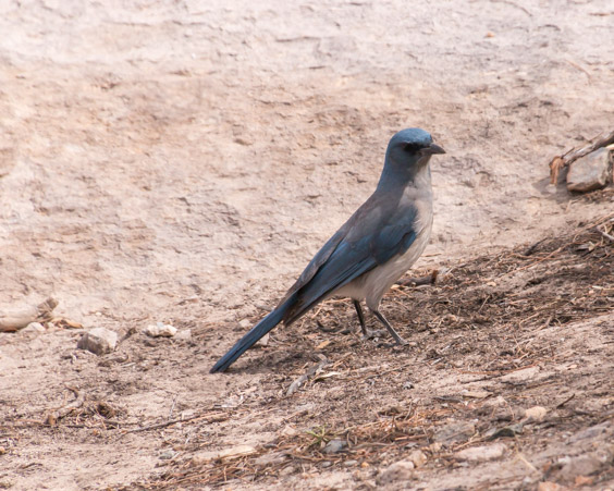
The trail climbs back up to the parking lot.
Where we found this guy pecking on the Jeep’s mirror.
About a quarter mile back down the road toward the visitor center is another trail system called the Echo Canyon Loop Trail. This trail was designed and engineered by Ed Riggs, owner of Faraway Ranch and one of the people who was instrumental in making Chiricahua into a National Monument.
The entire loop trail is 3.3 miles of breathtaking beauty. It descends into the valley where rock cliffs tower above. There is an option to hike only one half mile to an area known as The Grottoes. The Grottoes is a unique rock structure created by the power of wind and water. The path is easy and the climbs are gentle.

The sights along the way boggle the mind!

The trail hugs the cliff edge and winds among the rocks.


A new delight around every corner.


The trail sneaks through a secret passage.

Until you reach the entrance of the Grottoes.

Inside the Grottoes.

Jeff climbs up the back side to admire the giant rock stuck in the middle.

Following the trail further we find more wonders.


From here the trail leads down hill into the valley. It’s getting late though and we opt to turn back. On the way we stop to admire the trail construction.


Hiking opportunities are plentiful in the park though the two we chose offer the quickest way to see the most formations.
There’ s a little light left when we get back to the park entrance so we decide to check out Faraway Ranch. The history of the area begins with the Indians as well as white travelers looking for a way through the valley. Eventually Fort Bowie (which is another National Monument) was built nearby in order to protect travelers. While stationed at Fort Bowie a soldier named Erickson met and married his sweetheart. The Erickson’s settled in Bonita Canyon to live. They built Faraway Ranch and managed it as a guest ranch where people came to ride horses and explore the rocks. Later, management fell to their oldest daughter who ran it until the ranch was absorbed by the National Park. Tours of the ranch are offered by rangers at specific times but we were on our own.

The tack room still has hangers with horses names.

Front of the main house.

It’s all in the details.

Back of the house.
The chimney has names and dates carved all over it.


I’d be interested to know the history of the names.

Not a bad place to live!
A 0.3 mile trail leads to the Stafford cabin.

The cabin was built by Ja Hu Stafford for his young wife. It’s speculated that he built it in a hurry to beat the winter cold because it was built using unpeeled logs and gravelly mud. The earthquake of 1887 shook down the chimney and caused the hot spring which was irrigating the garden to turn cold and in 1918 the Erickson’s purchased the cabin to use for their guests.


We have a long way to go home and the hour grows late but there were no gas stations on the way here. Guess we’ll have to fill up ourselves!

We decide to drive home a different way, through Wilcox and Benson. By the time we reached Wilcox we were starving. There’s not much to the town, but during our explorations we came upon an old fashioned railroad car restaurant.
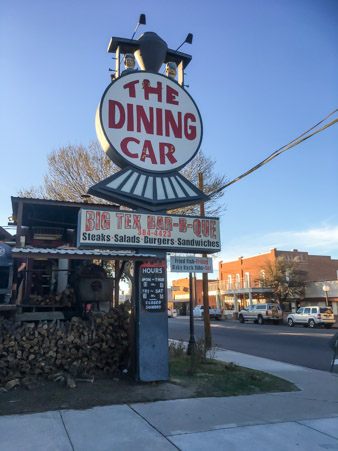
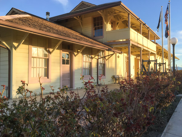
The restaurant is right across the street from the old depot building.
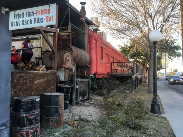
Modern railroad tracks run behind and without warning, trains pass through town at ridiculously high speeds !
I was disappointed that the interior of the dining car had been gutted and filled with tables. I remember in the good old days, the dining cars were original.
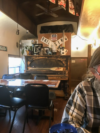
The restaurant is billed as a bar-b-que and the menu features sampler plates and bar-b-que meat options. Jeff opted for a brisket with fries and I chose a steak, potato and salad. When the meal came it was obvious that meat was their specialty. The salads and sides were an afterthought, sour cream and condiments were served in disposable packs but the minute I bit into my steak, all was forgiven. The steak was one of the best pieces of meat I’ve ever tasted, it was delicious!
After dinner we walked behind the restaurant where we noticed several food trucks. It all makes so much sense now. The bar-b-que must have started as a food truck and later moved into the dining car.
Whatever the history, it was a good meal and now time for bed!
