
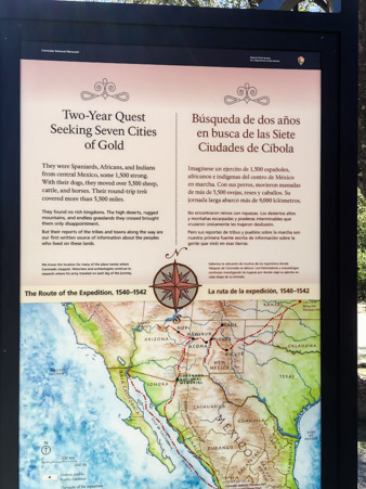
Have you ever set out on a quest hoping for a specific outcome, only to be sadly disappointed and feeling sorry for yourself?
Francisco Vazquez de Coronado y Lujan did exactly that and when we opted to follow in his footsteps, we had the same result.
The National Park Service oversees the Coronado National Memorial near Sierra Vista, Arizona in the town of Hereford.
The memorial is a Passport Stamp location so we decided to check it out.
The visitor center is in a beautiful little desert canyon.
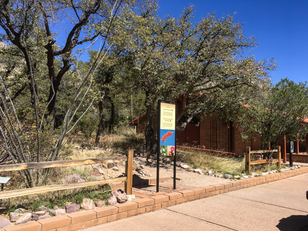
An interesting, circular, information stand sits in the courtyard.
Some signs tell a little of the history of the quest.
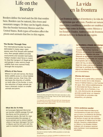
Others explain the struggles animals face when dealing with the border fence.
The visitor center is small. Filling the space are interactive exhibits, reproductions of weapons and displays highlighting the cultural changes that Mexico and Spain brought to the United States.
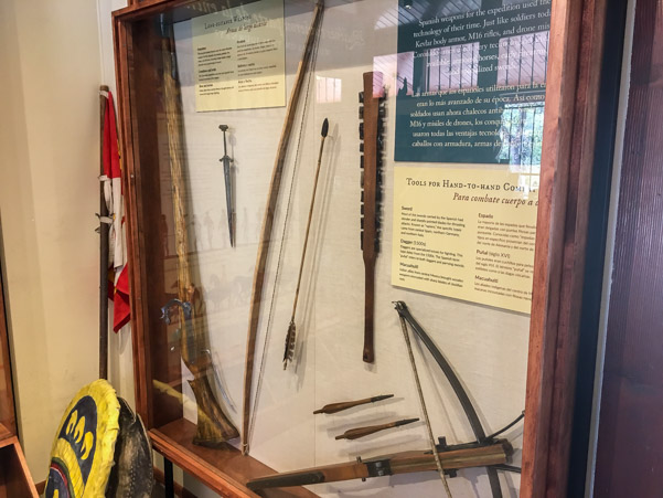
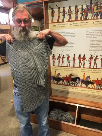
We especially enjoyed the chain mail exhibit. It was next to impossible to photograph inside due to the bright light from the windows.
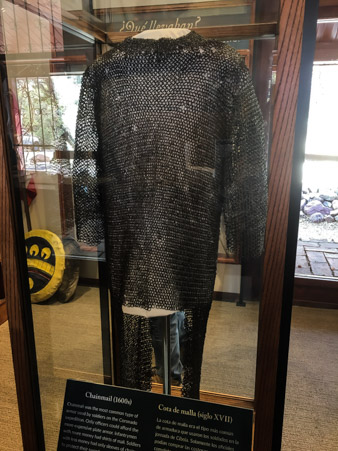
Chain Mail shirts and metal helmets are waiting for explorers to try them on.
The chain mail was really heavy!
While the actual route of Coronado cannot be absolutely determined, archaeological clues have helped to pinpoint some of the areas he visited.
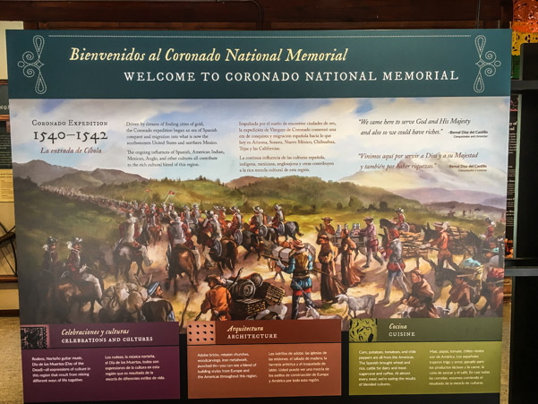
The uncertainty of the locations makes this a memorial rather than a monument which highlights an actual site.
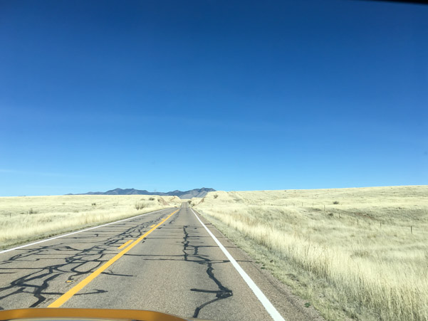
There are only a few things to do here, take a short drive to a peak, hike multiple trails, or explore a small, self tour cave.
We chose the peak which is Montezuma Pass, 6,575 feet.
It’s a short, well-graded, narrow, curvy, dirt road.


The view from the top was spectacular.
The border fence marches into the distance.

A large parking area sits at the top of the peak with views over both sides. A short hike to the very top has a clear overlook of both sides at once.
This is the back side, looking into Mexico somewhere. No fence in sight.

We were told the road down the back side leads to a lake.
The road is barely visible on the right.

The road is still well-graded but washboarded.
It goes for many miles so we stopped to air down.
While Jeff does the hard work I took another picture looking toward Mexico.

A sign described the area as a critical watershed.
The road goes on and on looking like this.

No deviation except for this small, canyon stream.

Somewhere along this road was a turn which led to the small cave. We didn’t see any signs for it, though we did see some small roads here and there. If you want to tour the cave know where you’re going and keep a close eye out for the turn.
Still not much to see except this guy.

According to some of the signs we passed, several small dirt roads lead directly to the border. From time to time we saw evidence of border control in the form of communication towers, occasional trucks and one fenced in area with a trailer.
The strangest thing of all though, was this blimp which looked like it was moving but apparently was not.

I love a mystery and Google provided the answer. The blimp is called an Aerostat and is used in border control. The blimps are tethered and contain monitoring equipment. They’ve helped to reduce illegal border crossings by a huge percentage. The history of the Aerostats is fascinating and well worth a read.
On we go down the road which had some rocky areas at this point.

Finally we see a lake in the distance.

This is Parker Canyon Lake. It was created to be a fishing lake funded by fishing license fees. There’s a nice little trail around the lake but not much else except fishing. It was quite crowded and seems to be very popular even though it’s out in the middle of nowhere. Trailer camping is available.


Just playing around.
This was the end of our dirt road “adventure” and we had a choice to make; Either drive all the way back the way we came, or continue the loop to our campground by way of a curvy, but paved, back road.
We hate to retrace our steps, forward we go.

This road is nuts!
Over, around, up and down, it meanders all over the hills and back down toward the desert, occasionally passing small ranches in the middle of Nothingville.
The strangest part about this road is the people we pass who are hauling HUGE trailers up to the lake.
Some of the curves were pretty severe and the dips sudden and deep.

The grasslands are spectacular but I’m about over it.
100 miles round trip, half of it dirt and little to show for it.
Game Over!
