
Simplicity, Peace, Tranquility.
All attributes of our ideal life.
Achieving it was our goal before we left home for our longest trip ever, a trip around the edge of the US.
We’ve spent the last six months at home doing our “Swedish Death Cleaning,” clearing our home of things that we don’t want or need anymore and preferably passing them on to people who do.
Our horses and petting zoo went to a therapy riding program, theater sets, props and some wardrobe to Crossroads Christian School, two truckloads of belongings were donated to the Salvation Army and numerous dumpsters full of trash hauled off to the dump.
We feel so much lighter!
…So, after taking care of some business and waiting for the weather to settle down we were finally ready to leave.
First stop Yuma Arizona.
We are staying at Rolle’s Lynda Vista Campground. It’s located in the older part of town surrounded by residential properties. The area is a little lower income but the park itself is extremely clean and well kept, the people are some of the nicest we’ve met. With Passport America it was only $16.00 a night. It’s far off the highway and very quiet, fruit trees all around. They have a lot of activities for residents like a pig roast the day we arrived. One night was Karaoke night but luckily they ended early!
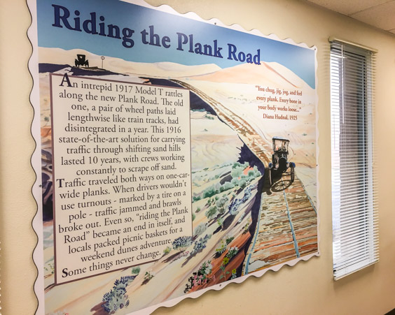
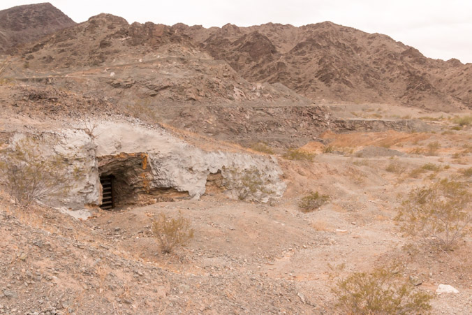
We visited Yuma once, when the kids were young. During that trip we saw the Territorial Prison, which was a very interesting site. Yuma has some excellent museums and a tourist mine but we really just wanted to get back out to the desert and do some exploring, starting with the plank road.
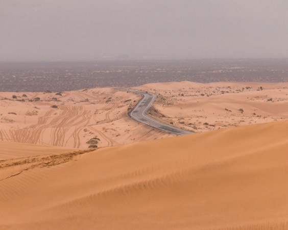
The plank road was seven miles long and was the only way to cross the Imperial Sand Dunes from the years 1914 to 1927. It was made in sections which were moved by teams of horses. There were double wide sections along the way where one car could pass another.
Over the years, the road wasn’t aging well. Campers used pieces for firewood and the road was being covered by sand. Finally, in 1973 and 1974, volunteers dug up and rescued portions of the deteriorating and disappearing road. They reassembled and preserved a piece of it near the Imperial Dunes Ranger Station.
The road is about three miles down from the station adjacent to a parking area.
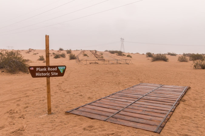
This is what the road would have looked like. It’s very narrow.
The actual road is in the distance.
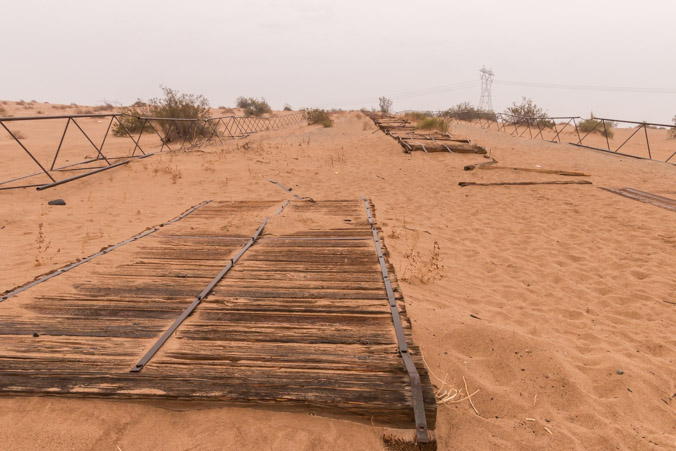
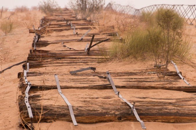
The road was built in sections so it could be moved as necessary.
What a bumpy, crazy ride that would have been!
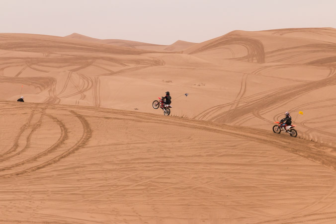
It was a drizzly, foggy day so after viewing the road, we decided to drive up to Glamis to see what was going on.
There were some brave souls riding in the rain and the dunes looked beautiful and mysterious in the fog.
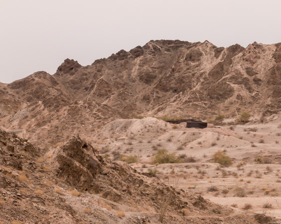
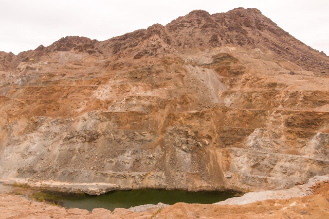
After watching the action for a while we decided to drive down Ogilby Road to check out the ghost town of Tumco. We followed information signs down a dirt road but before we got to the end, the road was blocked by a gate. Access to the town requires a hike of a mile and a half, uphill. Since this was our first stop, we were WAY too lazy to hike so we followed a side road into the mountains.
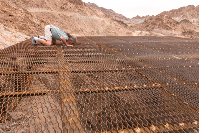
We came to a dead end blocked by a berm and lo and behold on the other side was the mine.
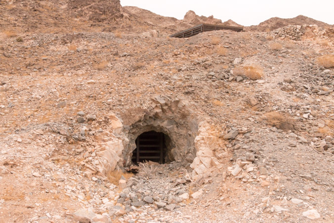
The vertical shaft was covered by a HUGE grate.
From this location we could see the old tanks in the distance.
We could have walked down into the townsite from here but opted to drive on.
On the way out of the area we stopped at the old town cemetery.
Looking at Google Maps I saw an old ore chute so we drove down The American Girl Mine road to look for it.
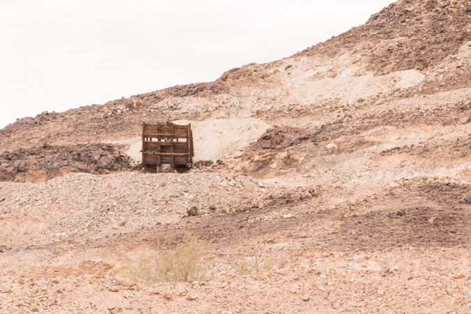
There it is, a relic from the past, right next to a modern mining operation.
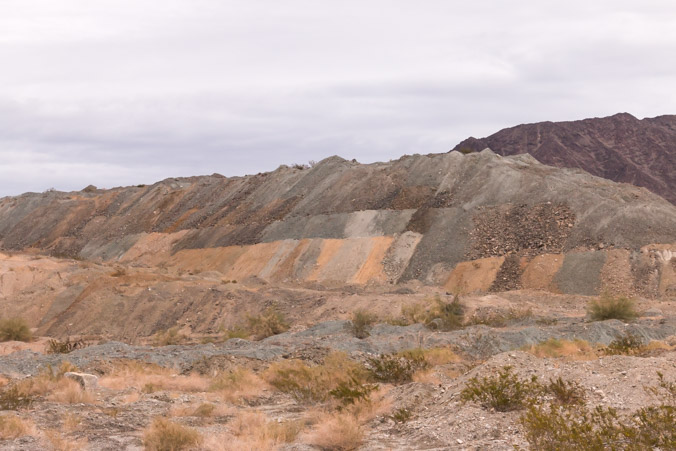
We followed the road around and into the mountains where we came upon the old townsite of Obregon which was abandoned in 1939. Not much here but strip mines and random mine roads and holes everywhere.
The tailings look like patchwork.
We wandered around and around in the area, looking for a way through to the opposite valley but every road was a dead end and more mines.
Admitting defeat, we went home because it was getting late.
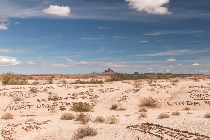
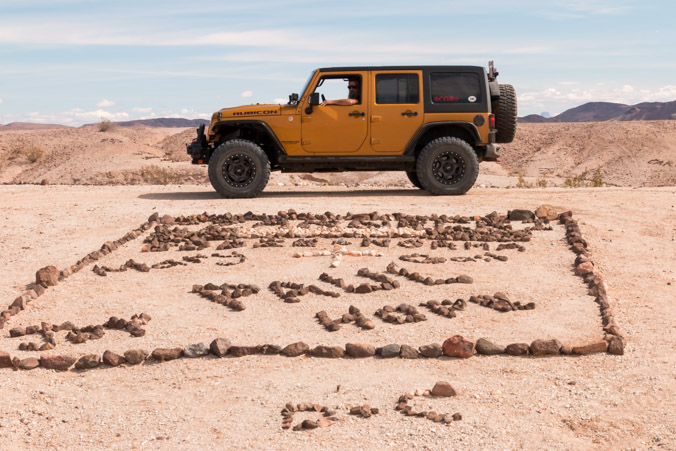
The reason that we wanted to get to the other valley was to see the Valley of The Names, so the next day we headed out bright and early to find it.
Soldiers training in the desert during WWII began writing their names on the ground by arranging black rocks on the white hills. Since that time, people have been writing their names in the same way on the surrounding desert terrain. Today there are thousands of names and messages. It’s possible to drive through the valleys, over the hills and around the names to see it all.
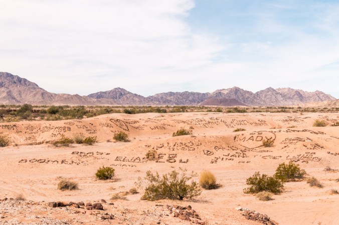
Pictures do not do this sight justice!
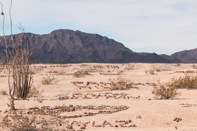
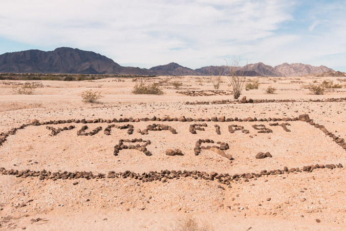
Some of the displays are huge, others are very ornate with multiple colors. I was disappointed to see that some people have been bringing bricks and spray painted colored rocks which ruins the whole aesthetic.
The display goes on for a mile or more.
When the names ran out we kept going following the road. It eventually led through a wash and up over the other side where it followed the rim. We decided to stop for a bite to eat. The views were incredible!
After lunch we went back through the wash to the main road.
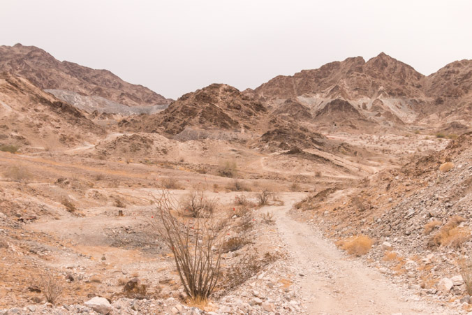
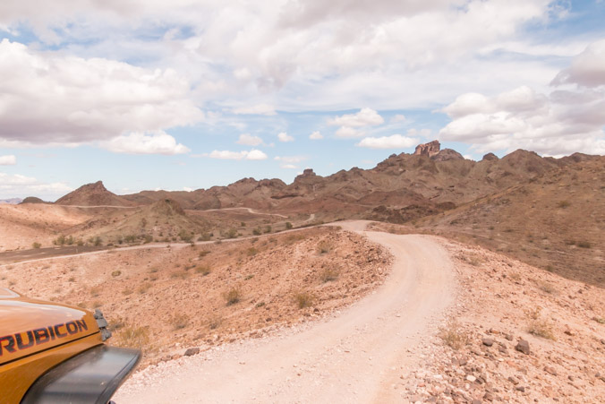
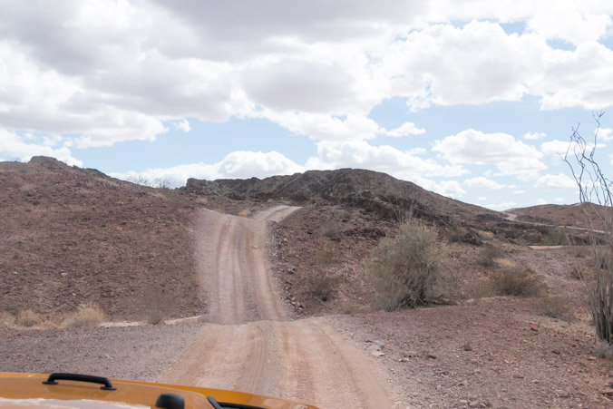
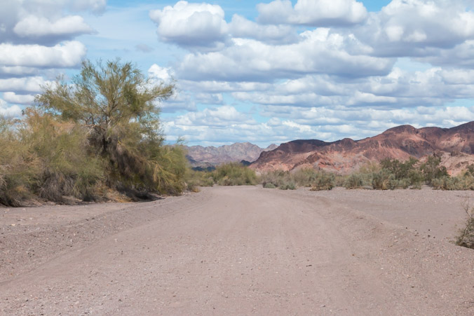
The plan was to just go out and connect with Picacho road again and follow it to the river. The road started out like this…
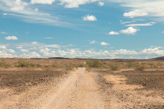
..But it quickly became this
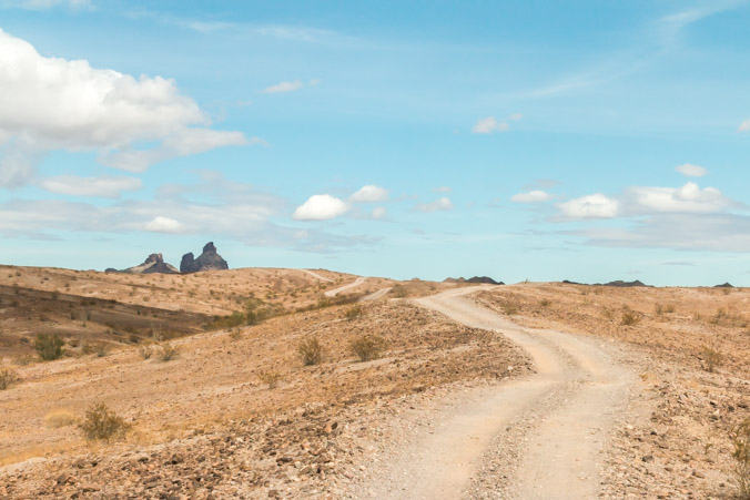
When we came to the crossroads and had to choose the main road or keep going on the rabbit trail over the ridges, we chose the rabbit trail.
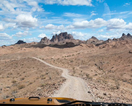
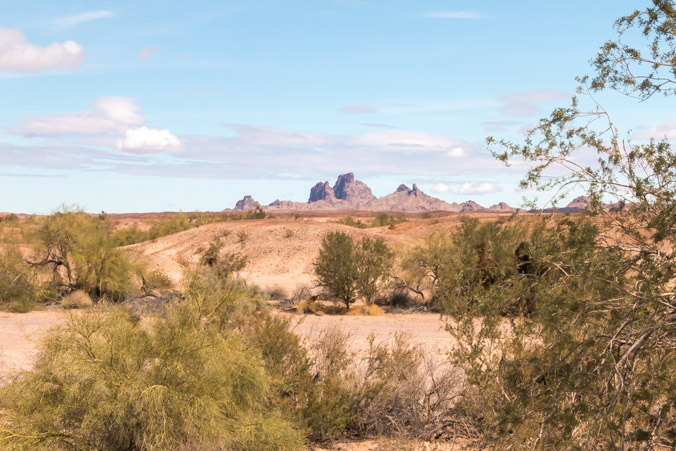
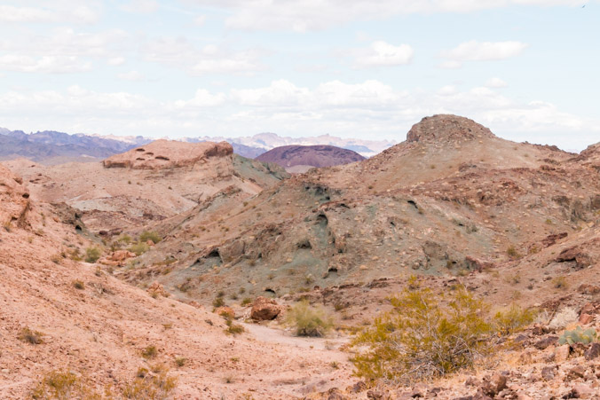
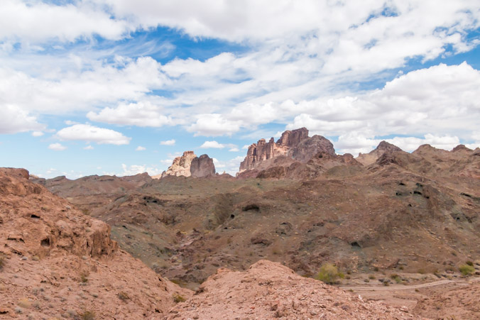
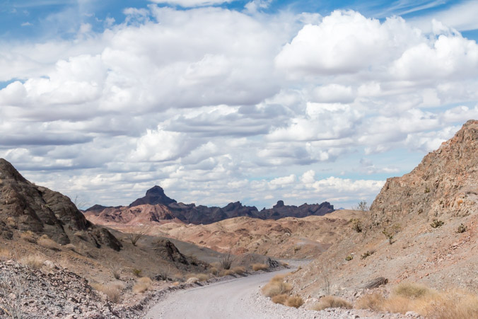
It eventually led up into the colorful mountains .
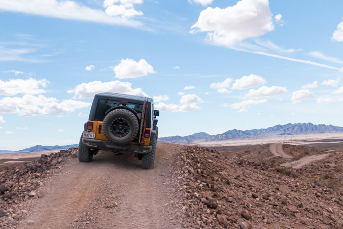
We were hoping that the road would lead around the mountain but shortly after this picture was taken we came to a washout. The road over the ridge got very skinny and one side was washed out. It looked like someone had driven across it by straddling the bad part so Jeff decided to try it while I guided him. It was very clear right away that we were way too wide to make it. The road was so narrow that backing up out of it was almost as bad as trying to drive through it. It took some maneuvering just to get back on solid ground.
I was so traumatized I forgot to take a picture!
…So back out the way we came…
And on to Picacho Road…
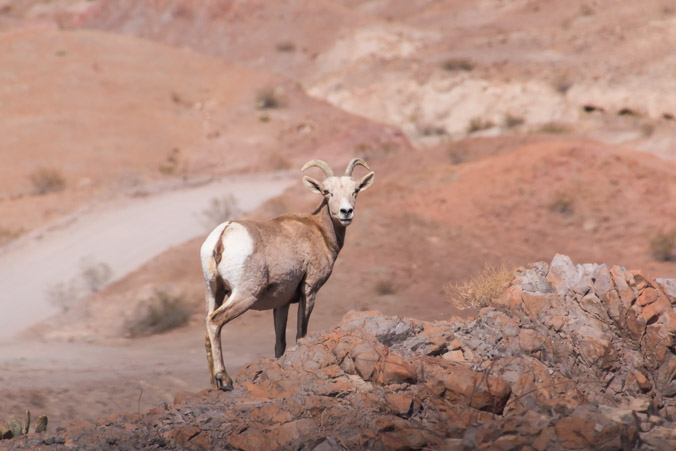
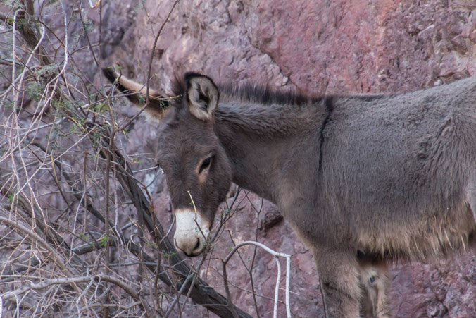
Where we saw this guy…
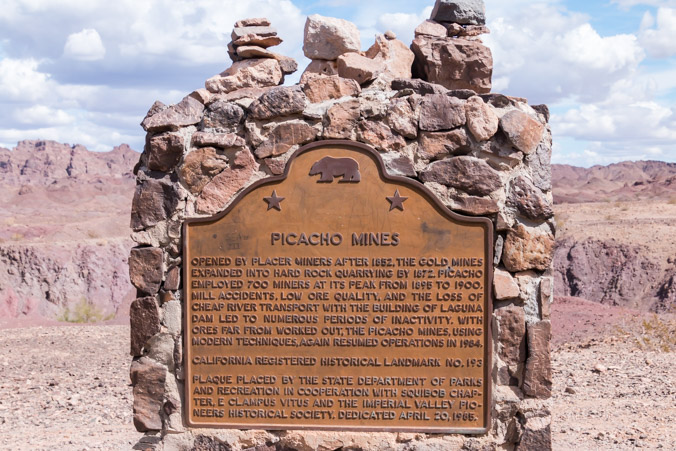
Lots of mining history here as well.
We saw some burros in Burro Wash.
Absolutely stunning scenery, so green and colorful.
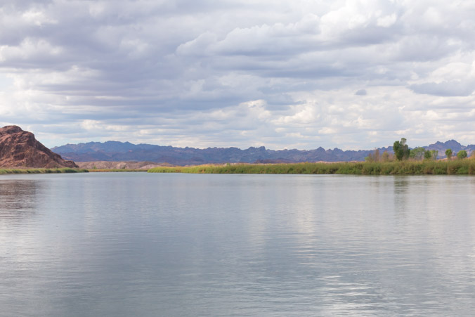
We finally made it to the picnic area at Picacho recreation site.
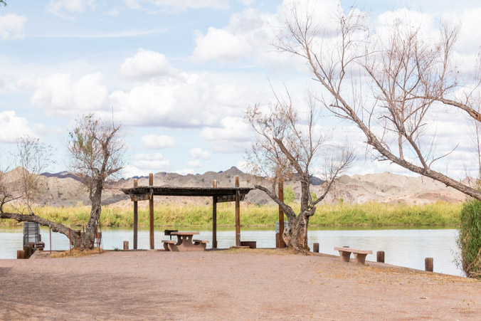
There was no one here this afternoon and it was so peaceful and pristine.
I could happily build a house right here.
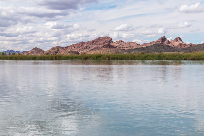
The beautiful Colorado River.
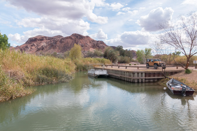
Before we drove back we decided to check out the camping area.
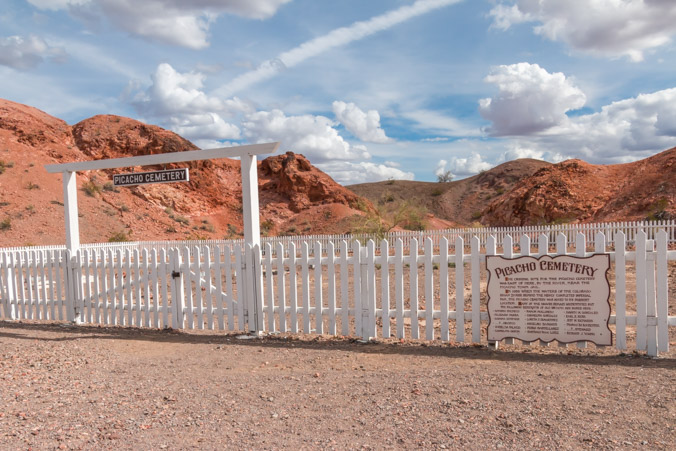
Apparently the main town of Picacho was covered by water but the cemetery was moved here to the campground.
Once again it was getting late so we drove back down Picacho road toward home.
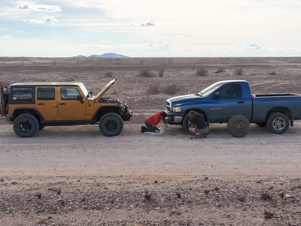
On the way out, we came upon this gentleman who was struggling with a flat tire. We stopped to see if we could help. Jeff used the air compressor to try if to refill the tire but it wouldn’t hold. The spare was also low so Jeff filled it with air and helped the man change the tire.
He was a sweet man and he said it made hime feel happy that we helped.
It would have been a good end to the day except Jeff had aired our tires down when we started this dirt road adventure and it was our turn to air up. Luckily he stopped to do it by one of the lovely canals that thread their way through Yuma.
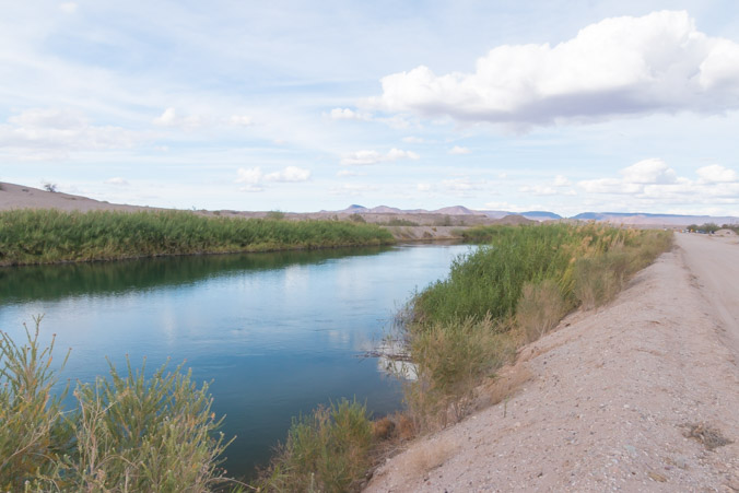
So I took pictures and here is my final view.
