 (This is a continuation of our first trip October 2015.)
Blizzard conditions! Whiteouts forecast!
Three feet of snow expected in mountain passes!
These are words that strike fear into the hearts of first time RVers…
Time to break out the maps and do some refiguring.
It turns out that heavy snow is expected on every path leading south from John Day Oregon but we thought we could skirt the edge of it by driving east to Twin Falls Idaho and then go south from there.
The next morning was Halloween and when we hooked up the Jeep and tested the tow lights.
They didn’t work.
Goblins?
Jeff had to spend some time tweaking and fiddling with the connection but finally got it fixed. Once again I’m happy he’s handy!
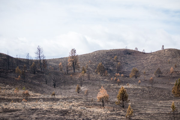
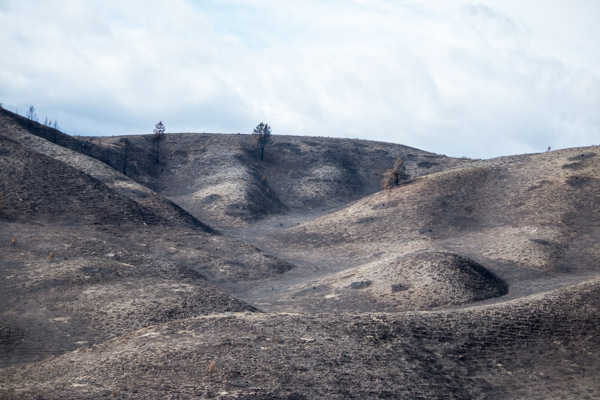
Driving Highway 26 east out of John Day, nice rolling hills most of the way.

Until we started passing through some of the recent fire damage.
It was devastating.
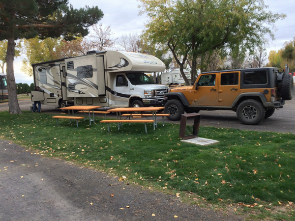
We arrived at Twin Falls/Jerome KOA at dusk. It’s right off Highway 93 in Jerome Idaho. We had reservations but the office was closed so we picked up our packet and settled in.
The campground wasn’t bad except there’s a large farm with trucks coming and going all night on one side and Highway 93 with semi-truck noise on the other.
Not the quietest of places.
Since we’re trying to out run the storm we only stayed one night. We were so close to Shoshone Falls though, I wanted to stop and see it on the way out of town.
But there’s a problem.
When I researched the road to the falls it looked very narrow and not RV friendly.
We decided that Jeff would drive the RV and I would drive the Jeep. We’d park in the Walmart parking lot near the falls then drive the jeep down to the overlook.
Great idea, looked simple on the map, but somehow Jeff missed the turn to the Walmart. Meanwhile, I’m driving behind him in the jeep, trying to navigate while calling him to tell him which way to go. He tells me to pass him and he’ll follow me instead.
Well duh, why didn’t I think of that!
Sometimes the obvious is not so obvious.
We finally made it to the Walmart after a driving a couple of miles out of our way. I was pretty much over it at that point, especially since the clouds were looking ominous but we’d come so far already.
We jumped in the jeep and drove down the road to the falls.
At first the road was curvy but not too bad, though the rocks were close.
Then came the hairpin curves.
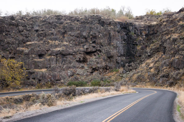
Then the center line went away and by this time I was glad we didn’t bring the RV!
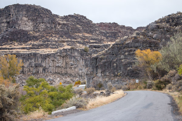
Finally we were treated to our first view of the falls…
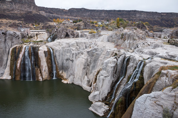
WHERE’S THE WATER????
We noticed some construction equipment around and then saw this sign.

I’m not sure exactly what they’re doing, or if the level of the water was due to drought, irrigation or construction. Whatever the reason, I was a little disappointed.
It was still scenic though.


There was another reason I wanted to visit the falls. From this point you can walk up a 1.8 mile trail to the ramp that Evel Knievel built for his unsuccessful 1974 rocket cycle jump over the Snake River. I remember watching him when I was a kid and I thought it would be neat to see what it looked like from his perspective.
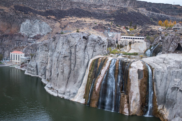
This is looking downriver from the falls to the approximate location of the ramp on the left side of the picture.

This is a portion of the trail leading up to the top where the ramp is.

We started to hike up the trail but the rain (which had previously been a sprinkle), turned into a downpour. Neither of us brought jackets but most importantly I had no protection for my camera so I shoved it under my shirt and we ran back to the Jeep.
Maybe next time.
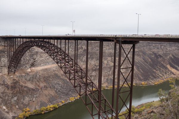
Since my dreams of rocket cycle glory were dashed, I decided I wanted to get a better look at the terrifying bridge we crossed on the way here.
A brand new visitor center and park overlook was recently built right next to the bridge so we stopped there before collecting the RV.
The visitor center had some state of the art multimedia displays, information and exhibits about the area, including a beautifully restored stagecoach

The bridge is called the I.B Perrine bridge. Named after an early Twin Falls settler. It was completed in July 1976, is 1500 feet in length and 486 feet above the Snake River. For those of us with fear of heights it’s intense!
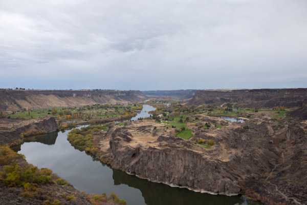
This is the view looking west.
There is a path that crosses under the bridge to the other side.
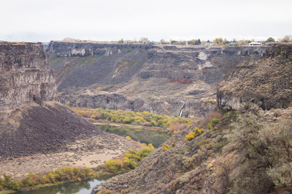
From here you can see Evel Knievel’s ramp.
(It’s the beige hill in the distance on the right of the gorge, upper left of the picture).
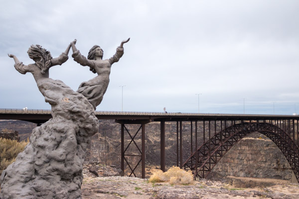
There’s also a beautiful statue and overlook on this side.
The most interesting thing about this bridge is that it’s the only man made structure in the U.S. that allows year round Base Jumping without a permit.
Base Jumping is a sport involving the use of a parachute to jump from fixed objects. Thousands of specially trained athletes from around the world jump from this bridge each year. You can even arrange to Tandem jump with one of them. No thank you!
The rain stopped while we were exploring the bridge and we’d noticed a bunch of men milling around the park doing nothing.
I wondered whether they were up to no good when suddenly they started bringing equipment out and I realized they were jumpers!

I was excited to watch, even though we really needed to get on the road to beat the storm.
Unfortunately the rain began again in earnest and they aborted the mission.
Oh well, for now we need to hurry to our next stop In Provo Utah.
