I have a bad habit of presuming I know what an experience will be like before I even step out the door.
I need to stop doing that…
Lately, I find more often than not, my preconceived notions are wrong.
During the planning stage of this trip I was looking for things to do within a reasonable driving distance of Portland.
What do you know?
Mount Saint Helens is less than a two hour drive from our RV park in Corbett.
Who doesn’t remember watching in awe when Mount Saint Helens erupted in 1980?
It was amazing to me that a volcano caused so much devastation in the continental U.S. I had no desire to go any where near it while it was still cranky but it’s been quiet for a while.
I thought it would be a fun trip. Until I started researching that is. When I read blogs and experiences of other people all I saw were pictures of mud and less than glowing reviews. The whole thing looked and sounded kind of bland but when we ran out of things to do we decided to drive out anyway.
There are multiple entrances to different sides of the mountain but we chose to visit the Johnston Ridge Observatory at the crater.
It was a one hour drive up the 5 freeway to highway 504 which is the road to the crater. About a half mile down highway 504 is the Silver Lake Visitors Center.
This visitor center charges $5.00 per adult. It’s brand new and has exhibits about the history of the area and of the people’s relation to the mountain. The most interesting to me was reading the the indian’s recollections of eruptions in the past.
Melted plastic items found in a recovered vehicle from the 1980 eruption brought a feeling of sadness.
It took about an hour to see most everything including a short movie.
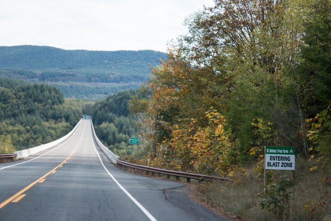
Back on the road, we drove through a beautiful, fragrant, green forest with no sign of devastation.
Until we came to a bridge and this sign.
I’d been noticing that the streams in the area seemed to have a lot more rock, gravel and debris than normal and suddenly I realized that it was all part of the mountain top that had blasted off and washed away, miles from the mountain. The mud slide reached all the way to the Columbia River. I guess I never truly thought about how much dirt was actually involved. I was surprised that it would still cover the land so deeply almost 30 years later.
We stopped at Elk Rock overlook and learning center which is focused on an area of the mud flow. It’s seen an increase of the elk population due to new growth of grass.
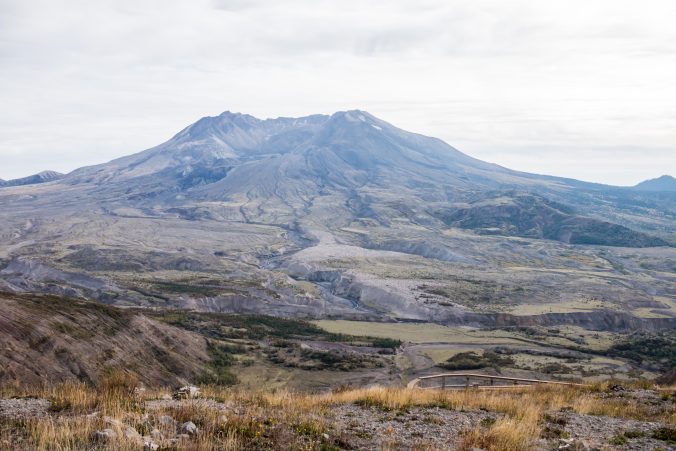
For us it was our first glimpse of Mount Saint Helens. Seen in the distance upper left.
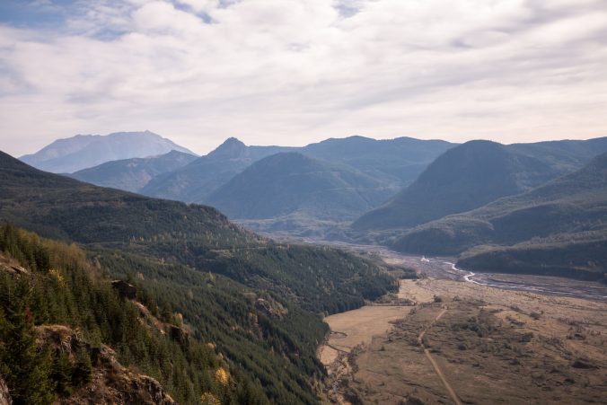
Looking the opposite direction. You can still see the devastation of the mud flow.
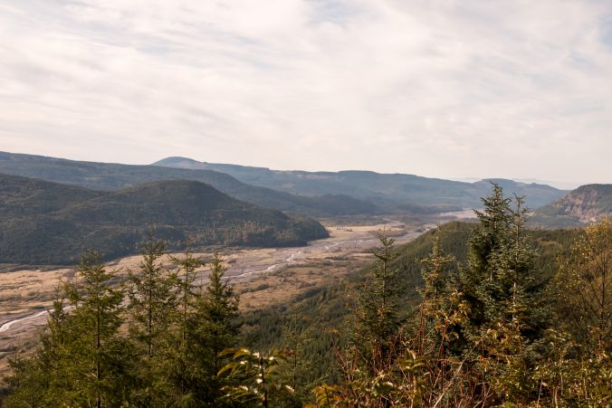
When the mountain erupted in 1980, thousands and thousands of trees were blown down like matchsticks but as we neared the observatory we still hadn’t seen any. Just a few logs sticking out of dirt embankments and a lot of broken stumps but not much else.
I found out later that the trees had been removed due to fear of insect damage and disease affecting the rest of the forest.
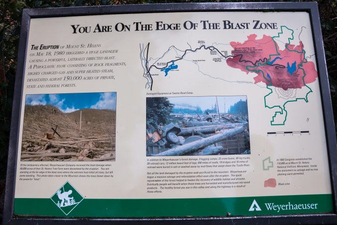
One of visitors centers is sponsored by Weyerhauser who has owned most of the forest since 1900. It was closed for the season but a lobby was open and I picked up some of the informational pamphlets they had. These are some amazing facts from the pamphlet.
- Nearly 68,000 acres of trees were destroyed.
- Weyerhauser lost 3 logging camps, multiple buildings and dozens of vehicles.
- 650 miles of roads, 19 bridges and 16 miles of railroad were buried in ash or washed away by mud flows.
- More than 1000 people were involved in the salvage effort.
- More than 600 truckloads of logs were removed each day.
- Salvage continued for two and a half years, concluding in November 1982.
- The recovery effort saved 850 million board feet of timber enough to build 85,000 three bedroom homes.
- The loggers had to replace blades frequently because the blast was so powerful that it embedded bits of rock and ash in the trees and these bits of rock and ash dulled the blades.
What a destructive force!
The forest we had been driving through was replanted by Weyerhauser after the blast. It’s kind of surreal because all of the trees are the same height, same size, branches equally spaced.
A clone forest.
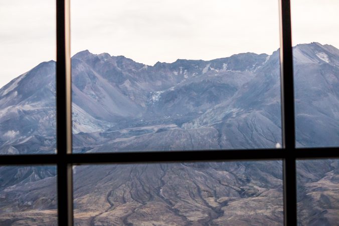
We finally made it to the observatory and walked to the top of the path where we had a clear view of the mountain….or what is left of it…
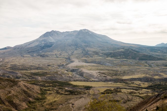
This is a normal view from the patio of the observatory.
Powerful is an inadequate word to describe it. To me it was like visiting the Grand Canyon, you simply cannot fathom the size and grandeur through pictures. It’s something you must see in person. I was awestruck at how close it seemed to be.
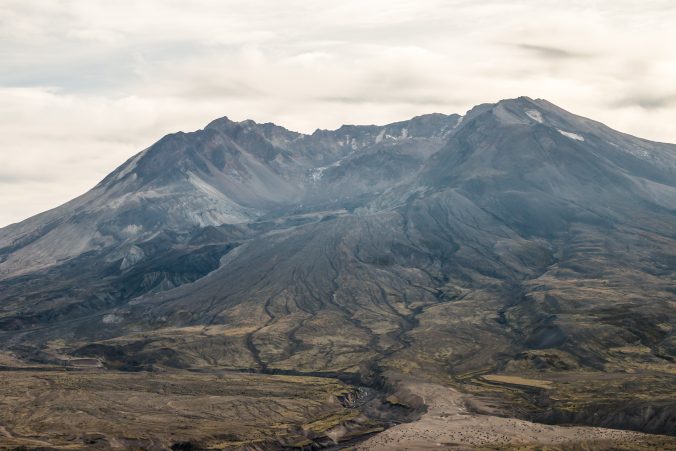
This is a zoom of the crater.
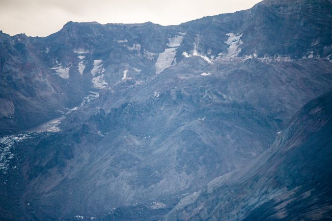
Super zoom of the swelling lava dome inside the crater.
The rangers give lectures on the patio with the crater in view. One of the talks was about the growth of the lava dome. After the eruption, the ridge we were sanding on was 1 inch closer to the mountain indicating a shrinkage of the magma chamber. Today the ridge is 1 inch farther away and the lava dome has grown. The mountain is recharging for another eruption.
It will happen someday.
That’s it’s pattern, erupting and then rebuilding to erupt again. There is so much monitoring equipment on and around the mountain that there would be ample time to notify people of any threat so I wasn’t too worried about it.
The rangers also gave a talk about the eruption itself.
This is a little of what we learned.
In 1980, Geologist David A. Johnston was camped on the ridge where the observatory is today. No one had any idea that the mountain would blow outward nor did they realize how powerful it would be. They’d been monitoring the growth of a bulge in the side of the mountain following a smaller eruption and the area had been evacuated. An exclusion zone was established to keep people out of the immediate area. Johnston was 6 miles away and was believed to be safe. The blast zone ended up extending further over 2 more ridges and valleys than the exclusion zone predicted.
Johnston’s last words were “Vancouver! Vancouver! This is it!” His body was never found. When the mountain blew it triggered one of the world’s largest recorded landslides. Thirteen hundred feet of mountaintop collapsed into the Toutle River Valley. This pyroclastic surge consisted of rock fragments, highly charged gas and superheated steam and claimed 57 lives.
Inside the visitors center there is a display telling the stories of victims and survivors in their own words. So incredibly moving and frightening all at the same time. The stories are unbelievable. One man told of clinging to a log and his wife at the same time as they hurtled downstream in the mudflow!
How awful!
But nothing can describe the feeling of watching an award winning movie documenting those horrific events in 1980 and then having the screen rise and the curtains open onto this.
A wall of windows facing the crater.
I couldn’t take enough pictures.
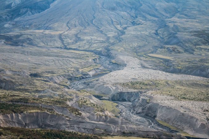
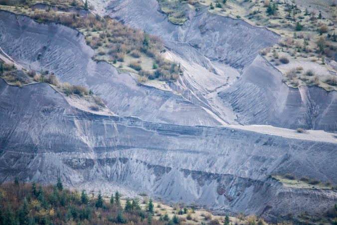
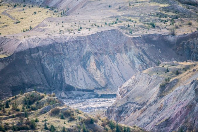
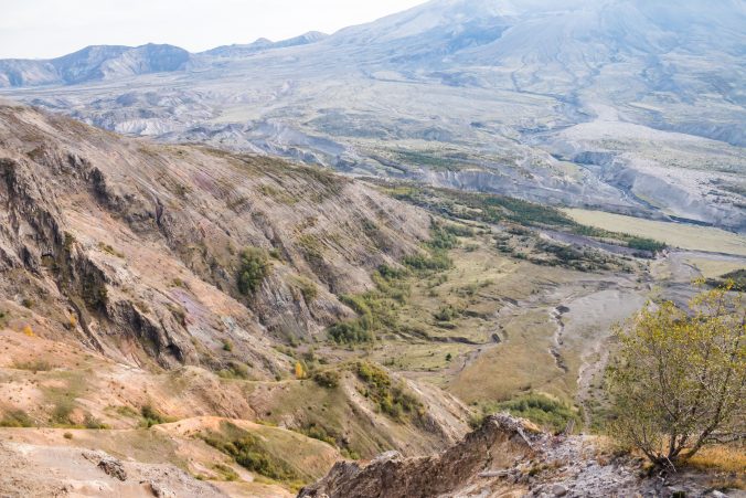
These are some zooms of the valley below the mountain. Notice the depth of the mud and ash. Those are full grown trees in the foreground.
There’s a trail at the visitor center which leads to the top of the ridge and across another ridge with interpretive sights along the way. It was getting really cold but we hiked to the top and these are the views.
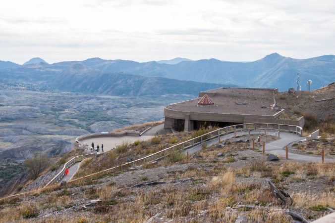
This is the observatory, it’s built into the ridge and the earth, rocks and logs cover part of the building.
Looking toward Spirit Lake in the distance.
Spirit Lake was completely redesigned by the eruption. The earthquake which accompanied the eruption caused a tsunami in the lake which pushed the lake water up into a canyon. When the lake water washed back down it brought all the trees with it. There’s a huge mat of trees floating on the lake to this day and scientists must continually monitor the lake levels. The debris clogs the emergency drain they put in place and the lake is constantly at risk of overflow.
Parts of the “blown down” forest has been preserved there. There’ s also a burned out car and a huge lava cave which was there before the eruption.
The road to Spirit Lake is on a different side of the mountain and another full day trip. If I had know what I know now, I would have camped closer and spent several days exploring.
It was getting late and the drive back to the 5 freeway was at least 45 minutes so it was time to leave.
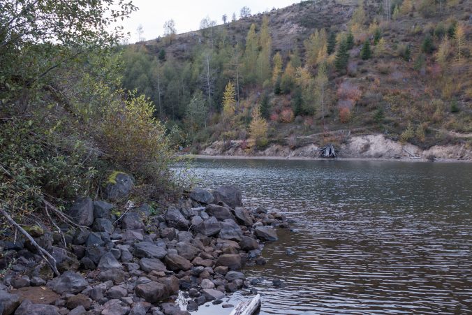
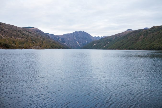
There was still a little light left when we passed a sign pointing to Coldwater Lake. Coldwater Lake did not exist before the eruption. It was formed when water backed up behind a natural dam created by a massive landslide.
We followed a path out to the lake.
Evidence of the landslide is obvious along the way.
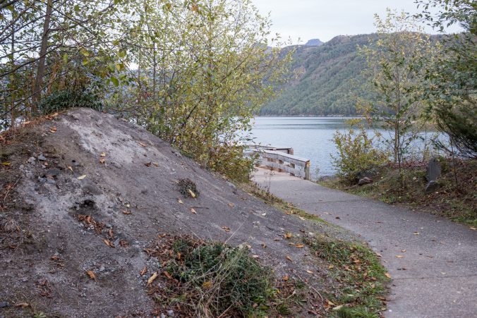
Piles of dirt.
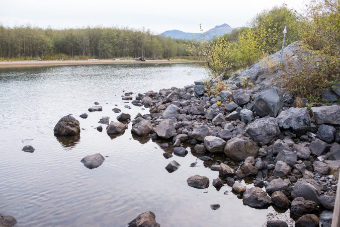
Piles of rocks.
It was a beautiful peaceful area. Lots of birds and a boardwalk through wetlands.
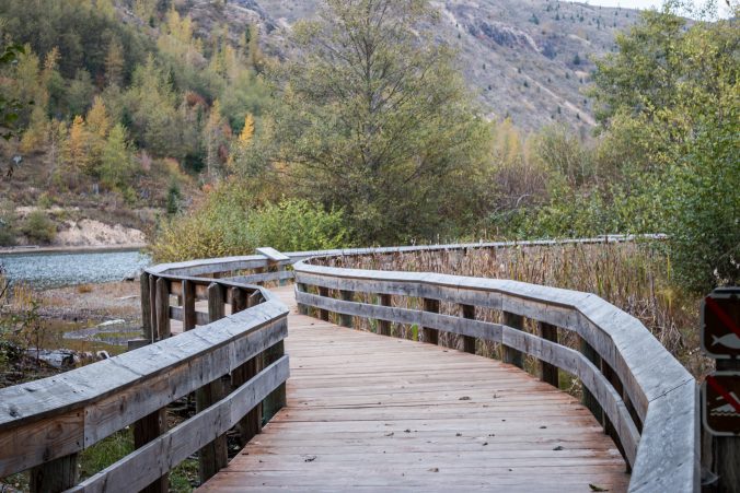
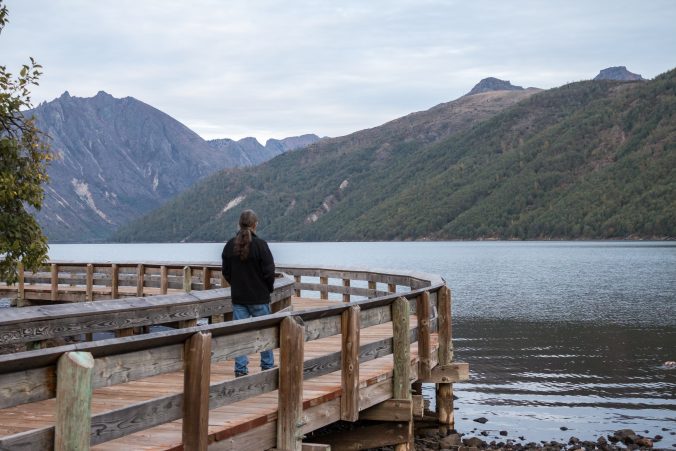
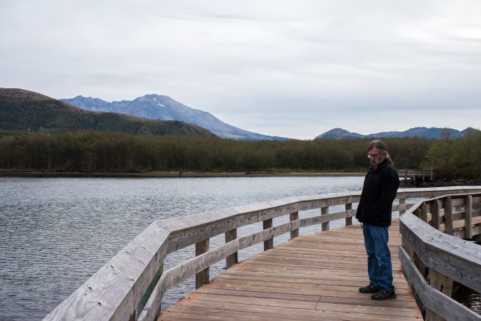
It was the perfect end to a perfect day.

It’s fascinating how nature recovers and transforms after such a powerful event.
LikeLike