
Tourists…they come in all shapes, sizes and abilities. Some lug around huge packs, hiking poles and Camelbak bladders, others walk up to an overlook, take a picture and leave and still others haul kayaks around on their heads to put in at rivers. Wherever they are, we try not to be. Sometimes it can’t be avoided.
Santa Elena Canyon is Big Bend National Park’s most iconic and oft visited structure and if we want to see it, we’ll have to drive the official scenic route of the park. There are two ways to accomplish this:
Option #1 – Enter at the Maverick Junction park gate, drive 13 miles to Castolon/Santa Elena Junction, take the Ross Maxwell Scenic Drive for about 30 miles to the canyon and then return the same way we came.
OR
Option #2 – Enter at the Maverick Junction park gate, take the first dirt road to the right, Old Maverick Road, drive about 13 miles to the canyon and then continue the loop back to the main road and out the Ross Maxwell Scenic Drive.
We really, truly hate to drive the same way twice so we chose option #2 – the dirt route, Old Maverick Road.
It’s the weekend and the park is more crowded than it has been. We wait at the gate a captive audience to… a bush.

Dirt roads are wonderful, a great way to appreciate the things not often seen but they are a little less wonderful when following someone who is kicking up dust. Today also happens to be a pretty bad day in terms of haze over the valley.


The dirt road is well graded. First view of Santa Elena Canyon unfortunately in the dust and haze.
A strange little “tent house” structure built low to the ground, was next to the road but we didn’t see it until it was too late to turn around. This valley has a lot of history of human habitation. Many ranches and homesteads, now owned by the park are preserved as historical structures. A detailed history of the residents can be obtained in the visitor centers.

A slightly better view but the haze is really thick. Santa Elena has the tallest cliffs forming a canyon wall – up to 1500 feet.

The road is nice and the views become more dramatic.

When we arrive at the parking area it’s pretty crowded.
A particularly pushy tourist is roaming the lot, looking for handouts.
The trail to the beach, at the canyon mouth is short and mostly covered with a boardwalk.

The boardwalk ends at a wide beach on the river.

Most people stop here to put in kayaks or take a picture.

Once again, the international border is the in center of the river. The U.S. is on this side and Mexico is on the opposite bank.

The hiking trail, which leads into the canyon, starts at this cliff.

First overlook looking into the canyon.

Going up.

Next overlook looking out over the beach.

100 million year old, fossilized, oyster shells form the walls of the cliff.

Lots of turtles in the river below.

The Rio Grande River is not very wide and not very deep here. Ninety percent of the water is used in agriculture and drinking.
It must have been spectacular, wild and free, when it carved this canyon.

Jeff on the paved switchback trail.

Looking down the way we came.

Looking out again at the amazing view, well worth the climb to get here.

Cliff edge trail.

The river narrows.

Looking back toward the canyon mouth, each view better than the last.
The trail leads down to the river bottom and along the edge of the cliff.


A gigantic boulder fell from the very top of the cliff. It must have made a tremendous explosion!

Tiny beauties.

The canyon narrows further still and the trail ends at water. At the end, looking back toward the entrance.

People were frolicking in the water.
It’s about knee deep.

The people at the top, middle of the picture are actually on the Mexico side. Other people were climbing the cliffs on the white rock. Borders don’t seem to matter to anyone in the depths of the canyon.


Back the way we came, past the giant boulder.

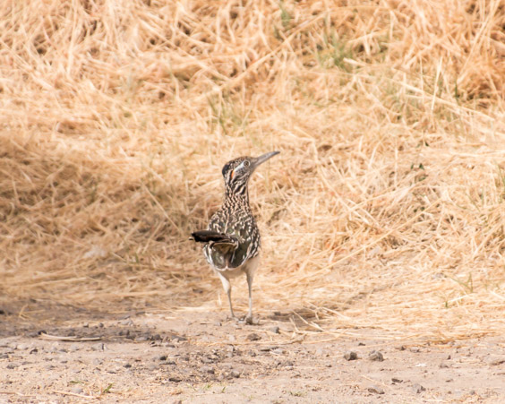
Many birds call this canyon home.

This one was quite a poser!

Must…Keep…Climbing…

…and back down.

One last look at this incredible place.
The next leg of our journey begins with pavement.
The Ross Maxwell Scenic Drive…done backwards.

The formation in the distance is known as Mules Ears. Difficult to see clearly in the haze. According to park information a desert hike to a small spring is nearby.

As mentioned before, people have inhabited the region for centuries.
Many structures can be seen from the road and hiking and historical information are available at the visitor center.
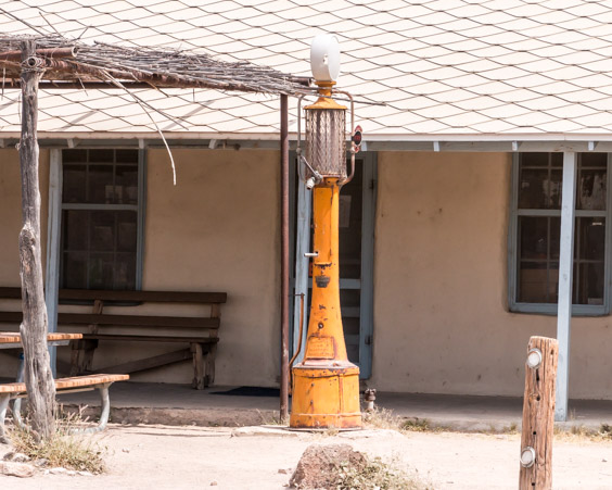
Castolon is one of the most intact, historically significant areas of human habitation within the park. Farming and ranching occurred continuously until 1961. The oldest known adobe structure in the park is here, as are two cemeteries and numerous exhibits of farm and ranch equipment.


La Harmonia store was an important trading post in the past. Today it’s a park concessioner, Castolone Store.
The scenic road continues, winding through beautiful country with many different types of landscapes.

Dramatic roadside views occur in Tuff Canyon.


The mountain above is called Cerro Castelon or Castelon peak. Comprised of several lava flows and ash falls, it’s an imposing sight .


Around the corner we get a closer view of Mule’s Ears…

…And dramatic cliffs around the next corner.


Close up of the holes worn into the sandstone.

I called this unusual rock pile The Cupcake.

The road flattens out and winds away into the distance.

Cliffs near the cutoff to the main road.

The opposite side. Much haze.

This little cone is one of the first sights on the main park road.
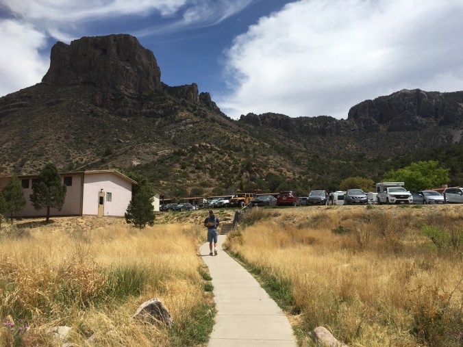
With our tour of the Ross Maxwell Scenic Road complete and some light left in the day, we head out for the most popular part of the park, Chisnos Basin. The Chisnos Basin road is a narrow, winding, mountain road which is not suitable for trailers. It leads up one side of the mountain and down the other, into a little basin valley. Camping, resort accommodations, a restaurant and small visitors center are located here.

The road leads up past dramatic cliffs and into pine trees.


First look down toward the basin.

The campground down below.

The motel/resort accommodations.
The rock cliff above is a popular nesting area for raptors.

Bears and mountain lions also frequent the valley.
A short, paved, loop trail leads around a small mountain for a deeper view into the basin. We started to walk it but changed our minds in favor of ice cream at the concession stand instead!

Alas, it’s time to call it a day. Down the mountain we go.

On the way home we take a last look at the abandoned mining operation on the mountain behind our RV park.
Tomorrow we leave Terlingua, Texas and drive to Del Rio, Texas. We’ll be continuing our explorations around the outside of the United States from there.
See you then!
